
By Doug Schneider
Click on images below to enlarge
Click on images below to enlarge
 |  |
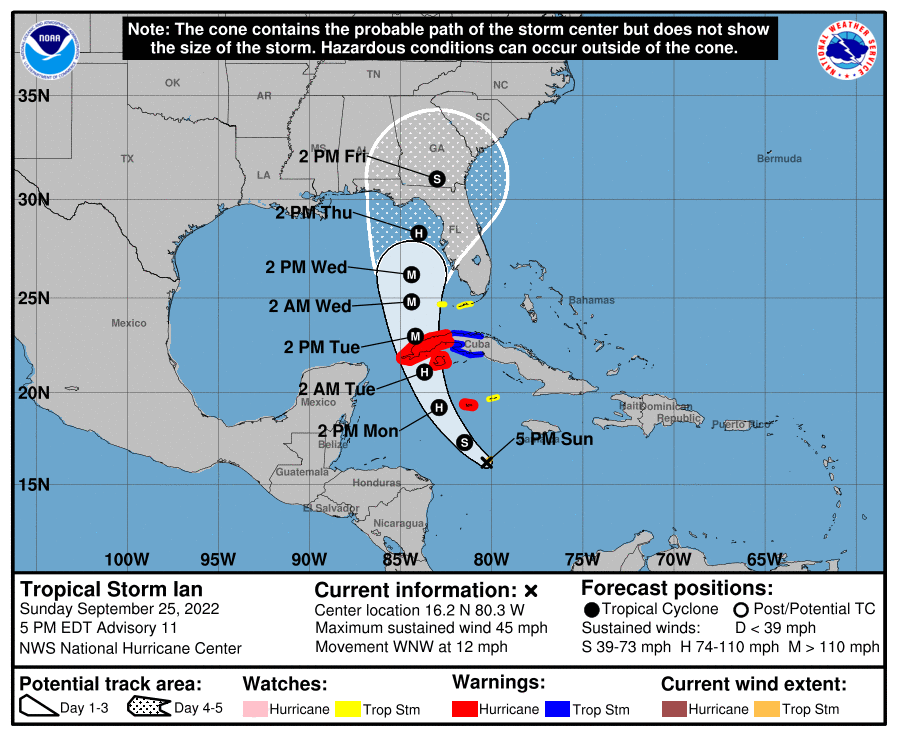
It's going to be a challenging week to forecast for Petit Le Mans. What is now Tropical Storm Ian in the Caribbean Sea is expected to track north and become a major hurricane as it moves into the Gulf of Mexico. Below is the forecast from the National Hurricane Center as of 5 pm EDT Sunday.
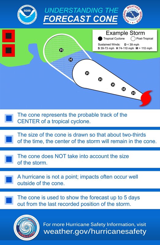
To better understand what the forecast cone means, here's a good graphic.
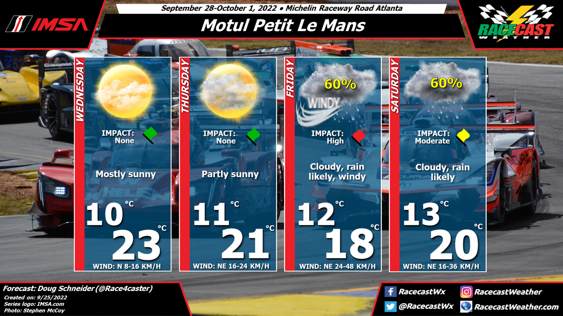
The current NHC forecast track has the potential to produce significant impacts at Road Atlanta on Friday, Friday night, and Saturday. There are a couple scenarios that will affect how much impact Ian will have on the racing.
Scenario 1 - Ian takes a track toward the eastern edge of the forecast cone, and makes landfall in the Florida Peninsula, somewhere near Tampa, and tracks northeast, staying offshore of the Georgia coast. In this scenario, I expect minimal impacts to Road Atlanta. If this happens, there may be some showers and breezy conditions on Friday, but I think the racing would be able to be held on schedule.
Scenario 2 - Ian takes a track that is in the middle or on the western side of the forecast cone, making landfall along the Florida Panhandle, and into Georgia. If this happens, there may be significant wind and rainfall at Road Atlanta on Friday into Saturday. This could cause major disruptions to the racing schedule, as well as pose a possible threat of downed trees and flooding. This could be a safety hazard to people who are camping.
As of today, I think Scenario 2 is the most likely one to happen. I don't know what IMSA can do to delay the event or reschedule, but the current forecast track and timing of Ian does not look good for holding a race with a track full of people in tents and campers.
I've seen some comparisons on Twitter between this year and to the 2015 race. This weather pattern is nothing like what happened in 2015. That year, Hurricane Joaquin was well off the Atlantic coast, near the Bahamas, and a low pressure trough over the central U.S. was drawing moisture from Joaquin to the northwest. There was a band of tropical moisture that produced heavy rain over Road Atlanta, but it was not directly associated with Joaquin. There was also no impact from wind.
This situation is very different. This is expected to be a major hurricane that makes landfall on the Florida coast, and tracks directly into Georgia. The impacts from this system could be much more significant than 2015, especially in regard to wind.
It is still early to say that any of this will happen with a high level of confidence, but the potential exists. I will have another post up here on Tuesday at the latest, but I will be posting on the @RacecastWx Twitter account every day with the latest forecast track and possible impacts on the event.


