
By Doug Schneider - @Race4caster
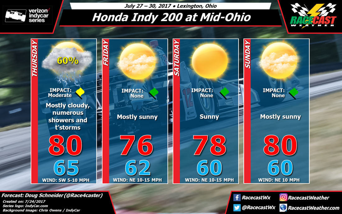
The weather looks great at Mid-Ohio this weekend for IndyCar, MRTI, and Pirelli World Challenge racing. While the practice day on Thursday will likely have showers and storms, the rest of the event is expected to stay dry with comfortable temperatures and humidity levels.
A cold front will be approaching Ohio from the northwest on Thursday, There is some uncertainty about the timing details of the storms ahead of the front, so at this point I can't be too specific about it, and there could be showers at any time of the day. The cold front will move through Thursday night, and all the rain will be out of the area by the time cars hit the track on Friday morning.
Behind the cold front, high pressure will settle into the Great Lakes region while a low pressure system will be east of the Appalachians, and this pattern will remain nearly stationary through the weekend. This will provide a north to northeasterly flow across Ohio that will keep temperatures and humidity levels very comfortable. High temperatures each day will be between 75 and 80, with low temperatures around 60. There will be a steady northeast breeze of 10 to 15 mph each day.
Unless there is a major change in what the models are showing, which I doubt, my next forecast update will likely be posted on Wednesday.


