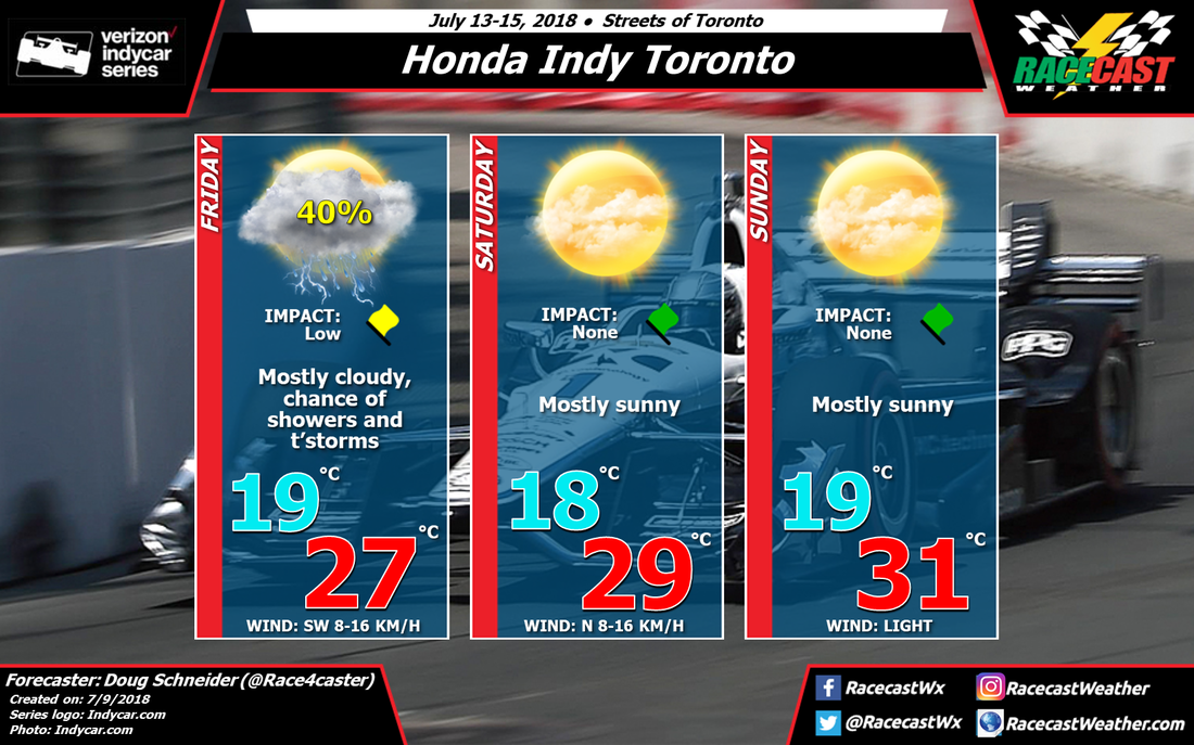
On Thursday, high pressure from the surface through the midlevels will be over the Great Lakes region, drifting toward the southeast, as a low pressure trough and cold front move across the Northern Plains and south-central Canada. This approaching system will bring a chance of rain to the Toronto area on Friday and Friday night. It does not appear to be a very strong system, and the rain probably won't be heavy or last for very long, but there are some timing uncertainties this far out in the forecast. It could arrive as early as Friday morning or as late as Friday evening. Later updates will pin down the timing a little more.
Another high pressure ridge builds in behind the departing trough, and will provide mostly sunny and warm conditions for Saturday and Sunday. Highs both days will be in the mid to upper 80s. One thing to keep an eye on will be if the Friday/Friday night system slows down even more than the models currently show, and rain continues into Saturday morning. I think that is unlikely at this point, so I am keeping Saturday completely dry with this initial forecast.


