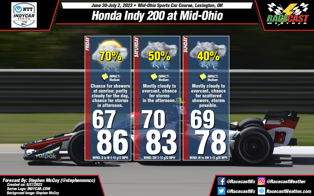
Entering the weekend, the mid Ohio region will be located between two major synoptic systems. A low pressure system is expected to be centered over Ontario, Canada with an area of high pressure located over the Southeastern United States. The anticyclonic rotation around the high will wrap moisture from the Gulf of Mexico through the southern Great Plains and into the Midwest, where the steering flow will be partially influenced by both pressure systems. A similar pattern will extend into the mid and upper levels of the atmosphere, resulting in plenty of cloud cover over the region.
For Friday, conditions will start mostly cloudy with a chance for showers as a surface trough approaches the region from the West, extending from the low pressure system over Ontario. Conditions will begin to clear for the late morning and early afternoon, which will cause temperatures to warm into the mid 80's for a high. The added moisture to the region will mean dew point temperatures will reach the mid 70's, resulting in heat index values in the mid 90's for the afternoon. Cloud cover will increase during the afternoon and evening as scattered thunderstorms may develop.
The aforementioned synoptic pattern is expected to continue into Saturday, resulting in mostly cloudy conditions through the day with heat index values in the low 90's. Scattered thunderstorms are possible again in the afternoon, which may have major impacts for the on-track sessions. Similar conditions may be present on Sunday, but with slightly cooler temperatures as winds shift to the West.


