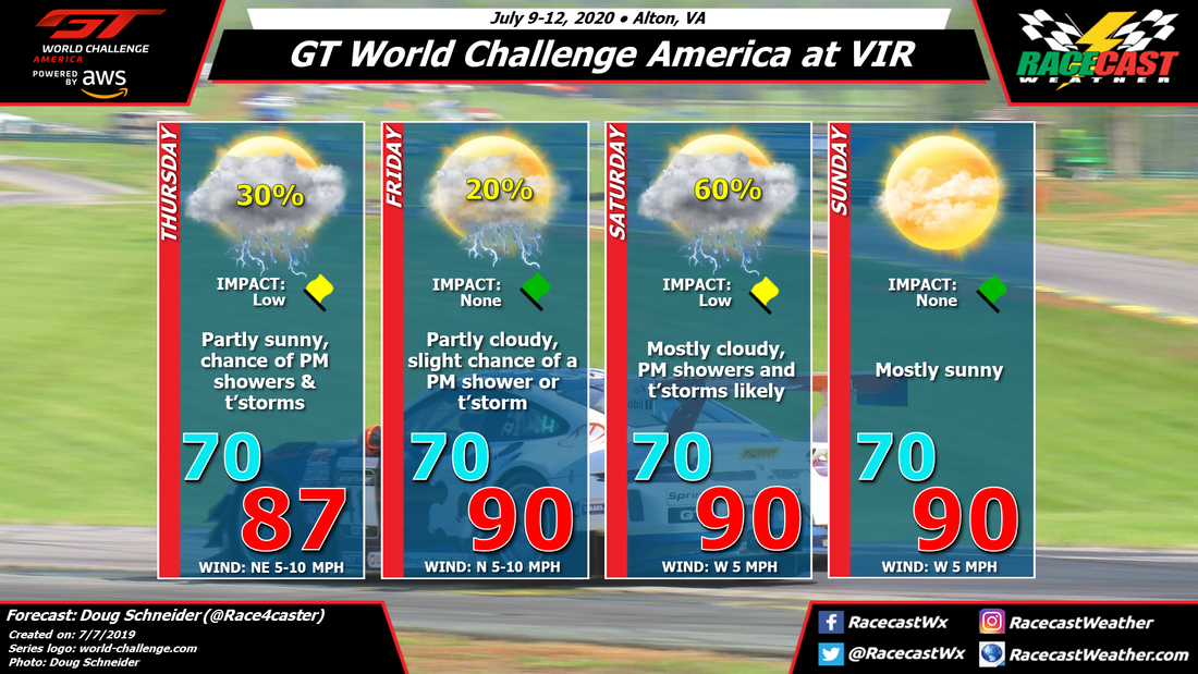
A low pressure system is expected to be moving northeast across South Carolina and eastern North Carolina on Thursday. Even though it's just a couple days away, there are some big differences between the models in their placement of this low, and how much rain it brings to VIR. I'm going to be optimistic with my forecast, and only have a 30% chance of afternoon showers and thunderstorms. This is how most of the models are leaning, but the NAM shows much greater shower coverage. Hopefully it's an outlier.
On Friday the low pressure system will be moving up the East Coast, and will no longer affect southern Virginia. With a lack of any significant high or low pressure systems in the area, I expect that Friday will be a typical summer day, with a few isolated showers or a thunderstorm possible in the afternoon, and a high around 90 degrees.
Saturday appears to have the best chance of rain as an upper level trough and a surface cold front approach from the west. This system will provide lift and instability that will favor the development of showers and thunderstorms, mainly in the afternoon. There is a little uncertainty about the timing of the trough passage, and if it comes earlier there could be some morning showers as well. But the afternoon will be the more likely timing.
Drier air aloft will build across the area behind this system, and which should result in a dry and mostly sunny day on Sunday. It will still be rather hot, with a high around 90.


