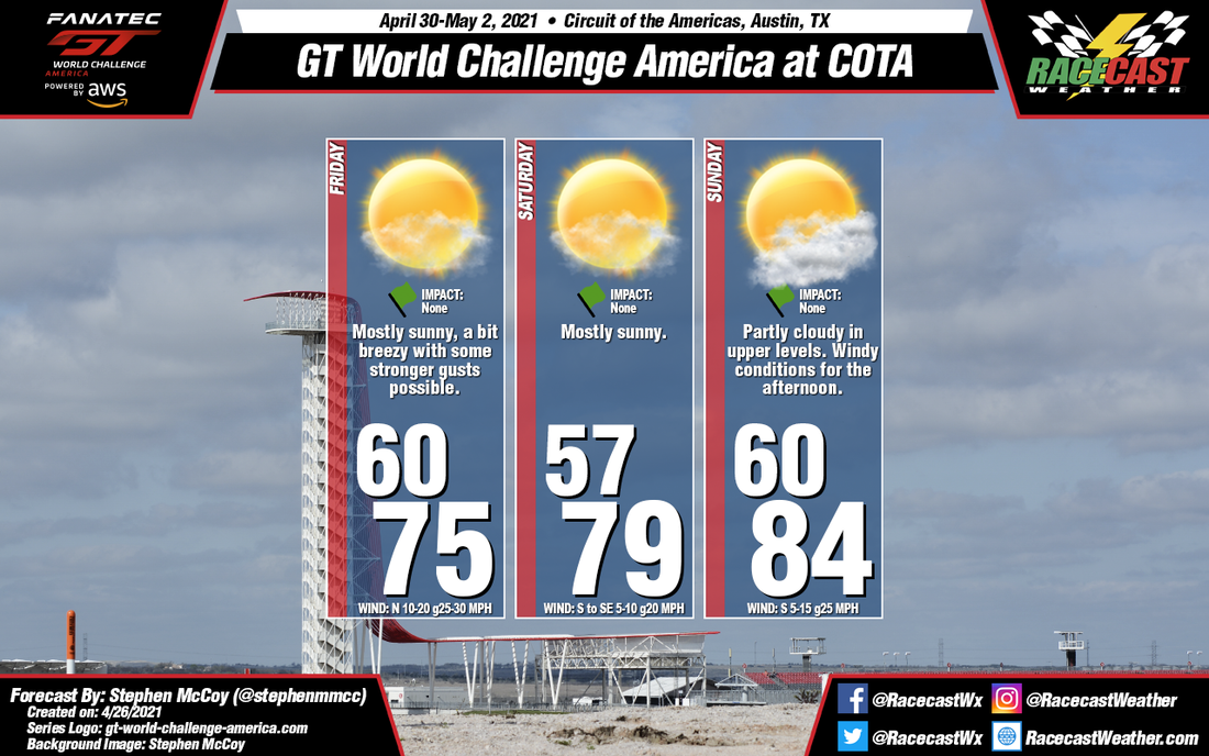
A cold front is expected to move through the southern US Wednesday into Thursday, bringing with it a chance for thunderstorms, with some of them severe; the NWS Storm Prediction Center currently gives a Marginal Risk (category 1 of 5) for this time period. Behind the front, high pressure will begin to build at the surface from the west, with winds largely from the north for Friday. These winds will bring slightly cooler temperatures to the region compared to earlier in the week. With surface and low level winds from the same direction, some stronger gusts can be expected, most likely in the afternoon. Winds from the north in the mid-to-upper levels will bring in drier air, resulting in mostly sunny to clear conditions for the day.
As the surface high pressure moves over the southern US, winds will begin to shift from the north to the south/southeast, causing temperatures to begin warming for the remaining part of the weekend. Much like Friday, winds will be from the north in the upper levels on Saturday, though more southwesterly winds will set in for Sunday, causing a bit of upper level cloud cover during the day.


