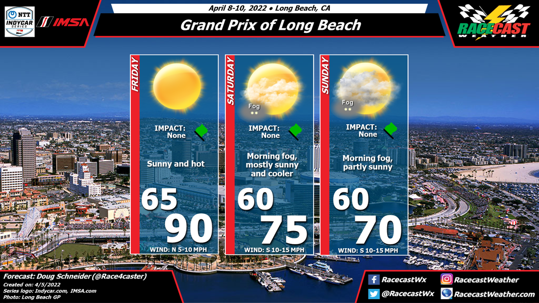
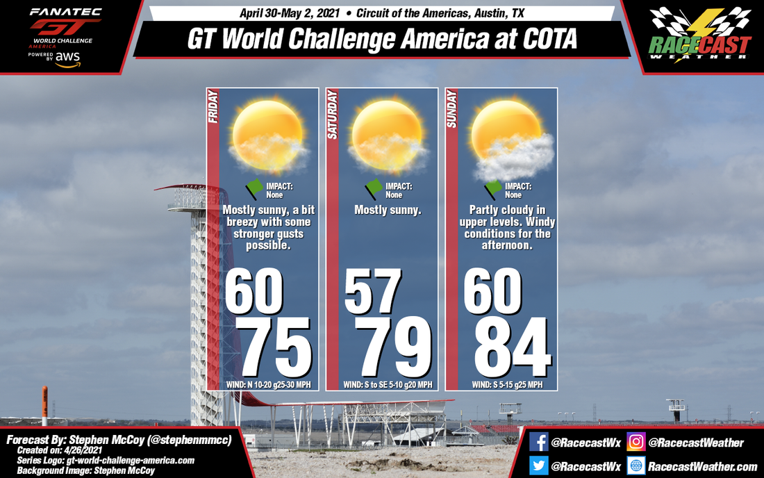
By: Stephen McCoy
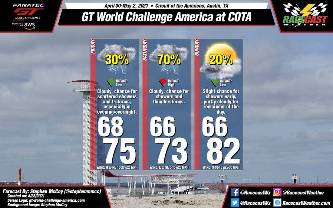
Mixed conditions will start the event off on Friday and will improve as the weekend progresses.
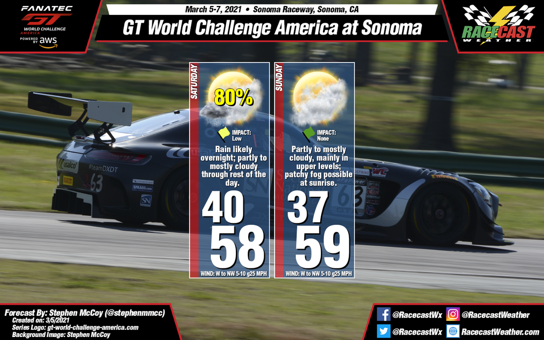
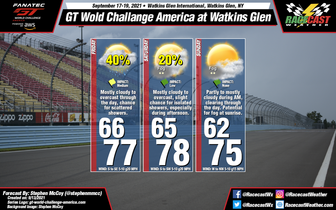
Around mid-week, a low pressure system will move eastwards over Canada to the north of the region. This system will bring a cold front through the area with a high percentage of rainfall and a drop in temperatures expected Wednesday into Thursday. A second low will take a similar route as the first during the early part of the weekend with its warm front moving northward through New England Thursday into Friday morning. This will allow temperatures to warm again into the upper 70's, which will remain largely consistent through the next few days. Of note: the National Hurricane Center has identified a disturbance in the Atlantic which has a 50% chance to develop into a tropical system within the next 5 days. Current model guidance suggests the system will curve along the east coast before moving out into the northern Atlantic. This has been brought up as its location at the beginning of the weekend will bring moisture from the Atlantic to the region, resulting in a chance for scattered showers through the day, especially during the afternoon. As mentioned, conditions will improve for the remainder of the weekend as the low and potential tropical system move further eastward. Winds shifting to the west/northwest on Sunday will bring slightly cooler temperatures and clearer conditions. Saturated air at the surface and a temperature inversion just above the surface will result in a potential for fog for both Saturday and Sunday morning.
Around mid-week, a low pressure system will move eastwards over Canada to the north of the region. This system will bring a cold front through the area with a high percentage of rainfall and a drop in temperatures expected Wednesday into Thursday. A second low will take a similar route as the first during the early part of the weekend with its warm front moving northward through New England Thursday into Friday morning. This will allow temperatures to warm again into the upper 70's, which will remain largely consistent through the next few days. Of note: the National Hurricane Center has identified a disturbance in the Atlantic which has a 50% chance to develop into a tropical system within the next 5 days. Current model guidance suggests the system will curve along the east coast before moving out into the northern Atlantic. This has been brought up as its location at the beginning of the weekend will bring moisture from the Atlantic to the region, resulting in a chance for scattered showers through the day, especially during the afternoon. As mentioned, conditions will improve for the remainder of the weekend as the low and potential tropical system move further eastward. Winds shifting to the west/northwest on Sunday will bring slightly cooler temperatures and clearer conditions. Saturated air at the surface and a temperature inversion just above the surface will result in a potential for fog for both Saturday and Sunday morning.