By Doug Schneider - @Race4caster
 |  |
Click images to enlarge
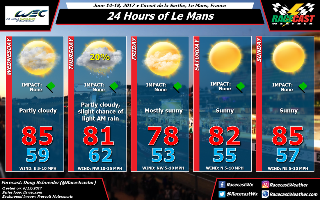
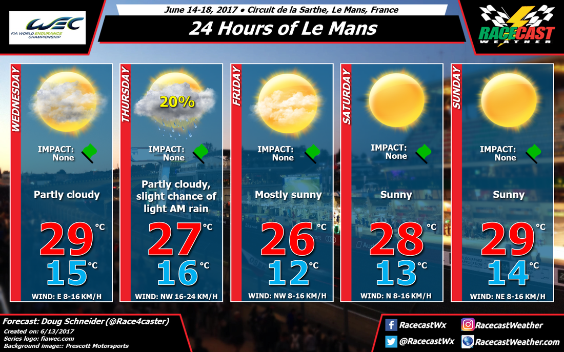
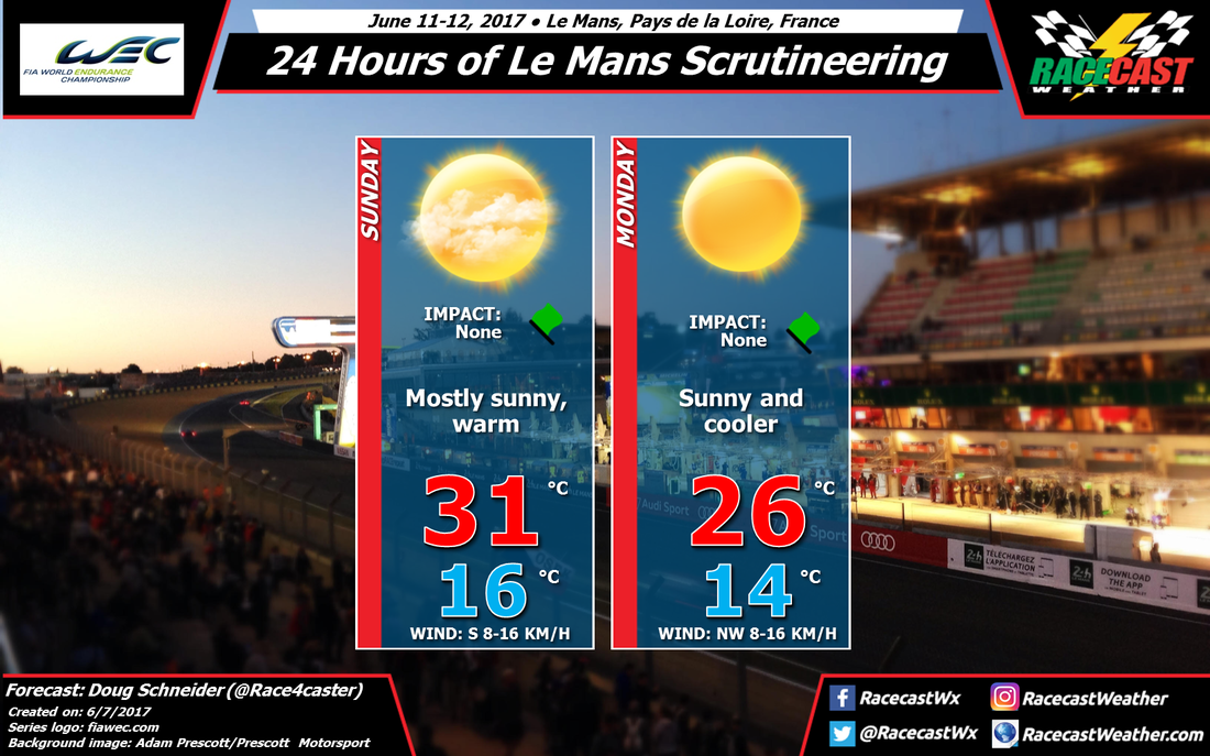
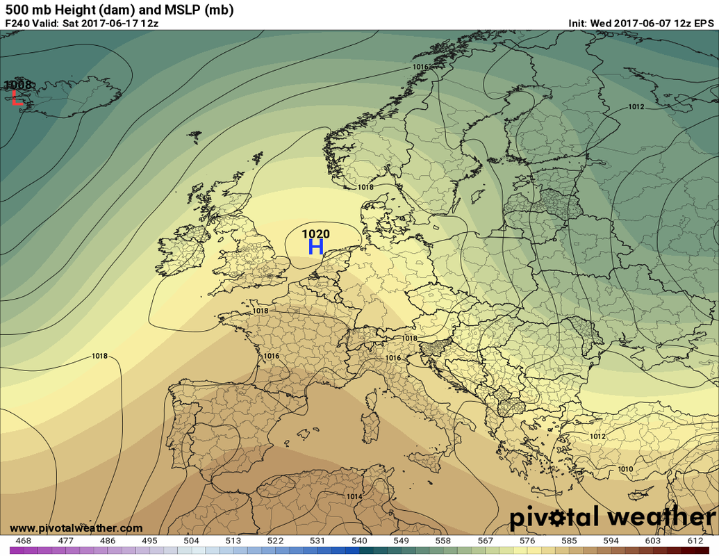
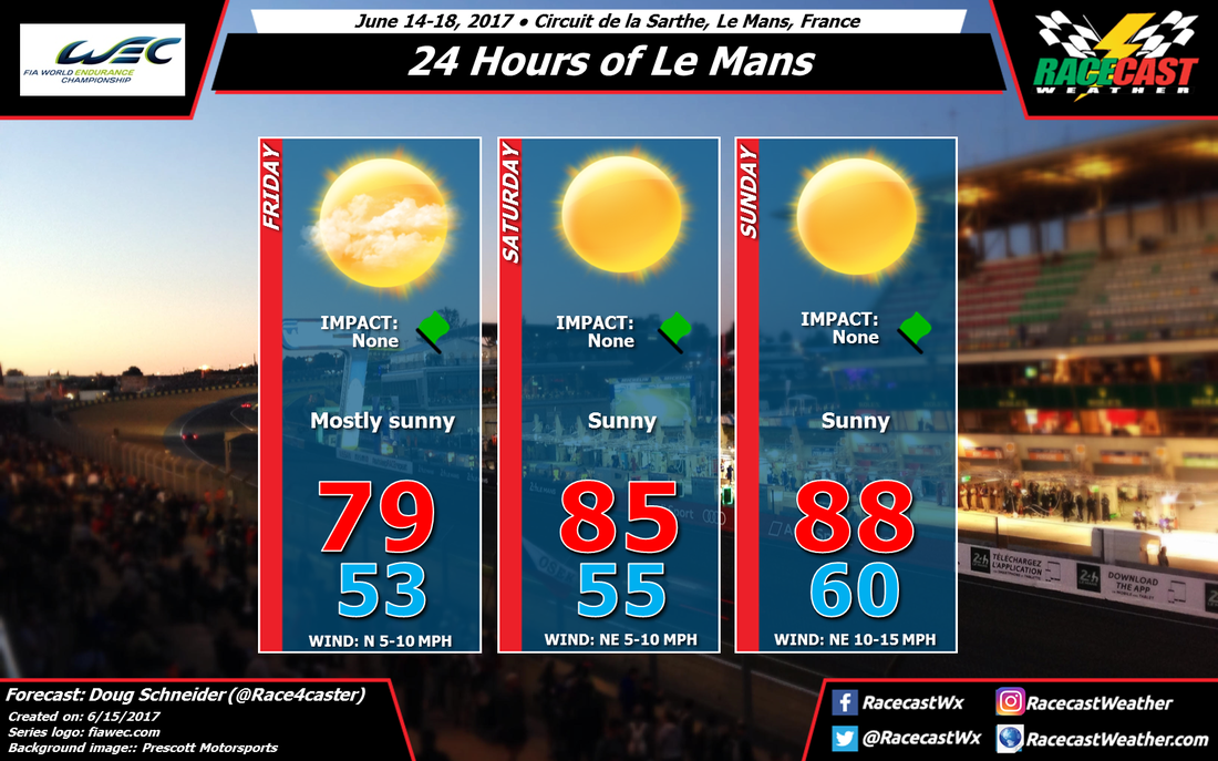
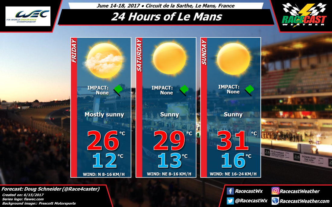
The weather continues to look great for the 24 Hours of Le Mans. Surface high pressure will be located near the English Channel Friday through Sunday, while a strong ridge in the mid and upper levels of the atmosphere will be across France. This ridge is trending a little stronger in the latest model runs, which is why I have bumped up the temperatures a few degrees for today's forecast update. With the strong ridge in place, there will be lots of sunshine and no chance of rain for the driver's parade on Friday and throughout race.
I'll have a more detailed forecast of temperatures through the race on Saturday morning.
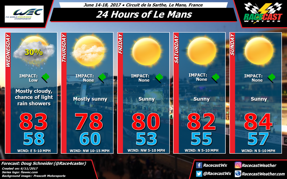
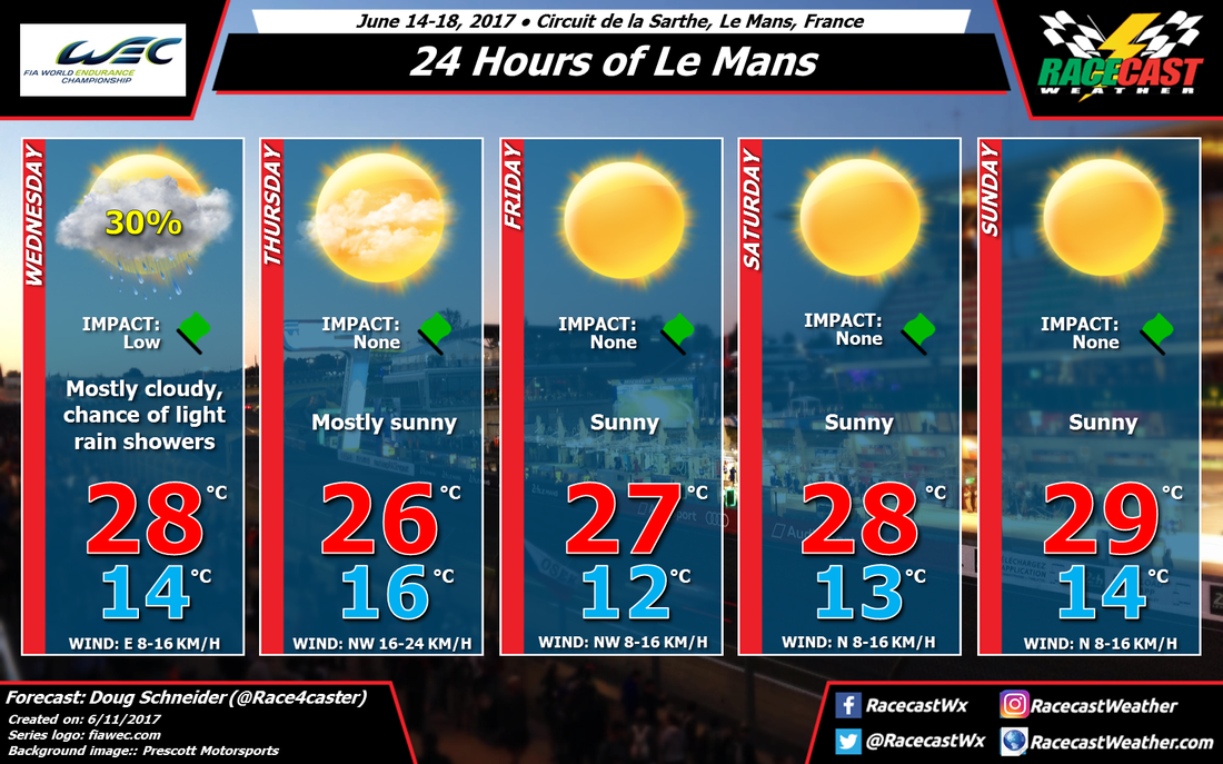
I'll have a more detailed forecast of temperatures through the race on Saturday morning.