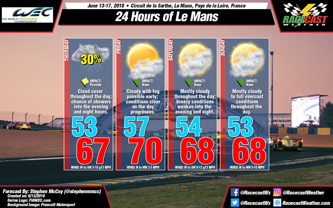
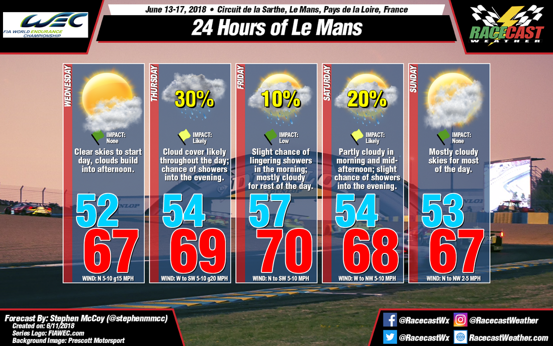
By: Stephen McCoy
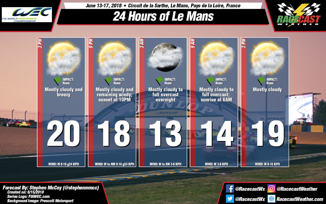

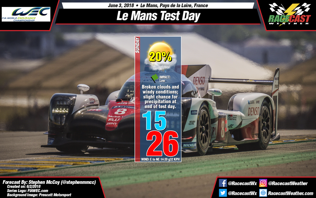
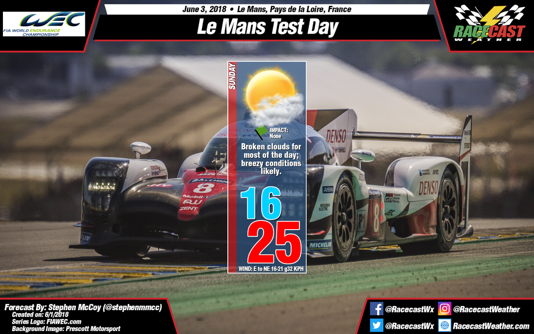
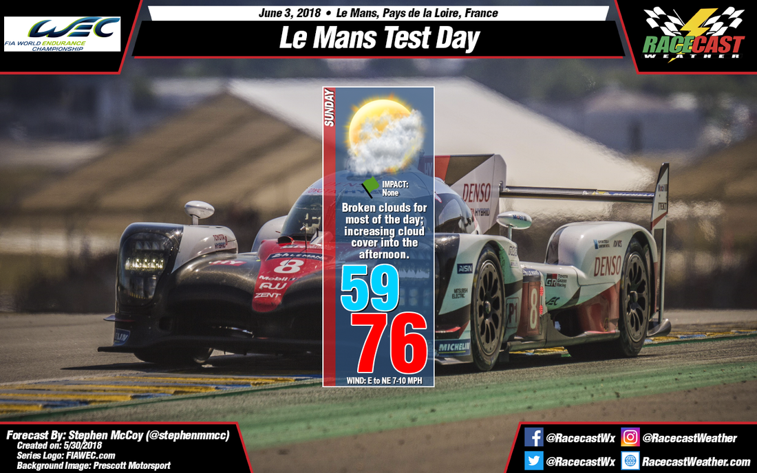
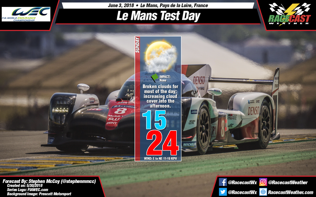
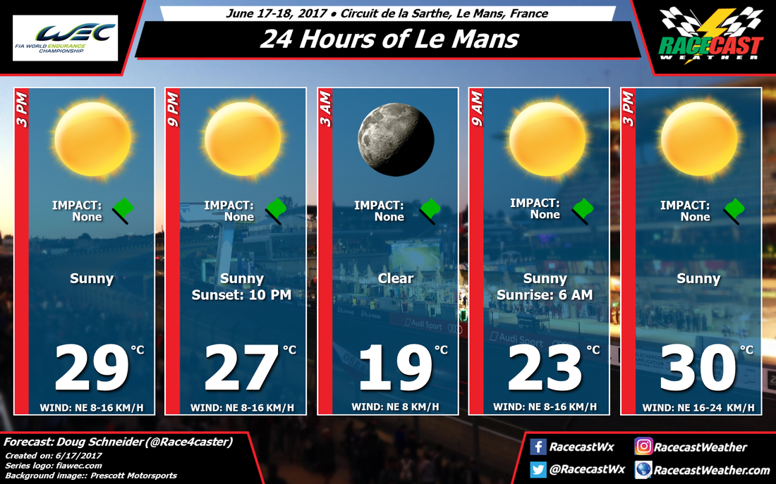
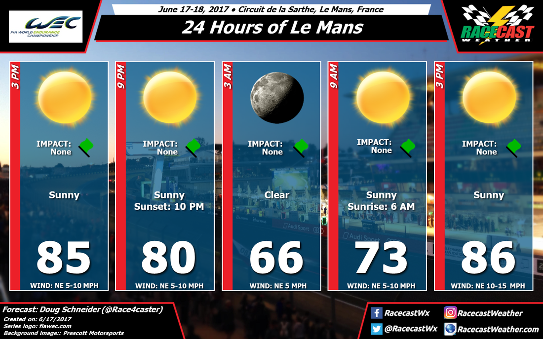
Lots of clouds for raceday at the 24 Hours of Le Mans. Temperatures for the start of the race will be consistent with previous forecasts, being in the upper 60s F, or around 20 C. A surface low pressure system is expected north of the British Isles and will move eastward through the forecast period. A cold front extending into northern France will move through the region during this time, and is the reason for some stronger winds at the start of the race. The front will move out of the region around midnight weakening winds through the night and morning on Sunday. Temperatures at the end of the race will be similar to those at the start.
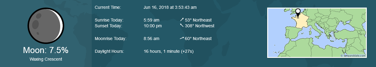
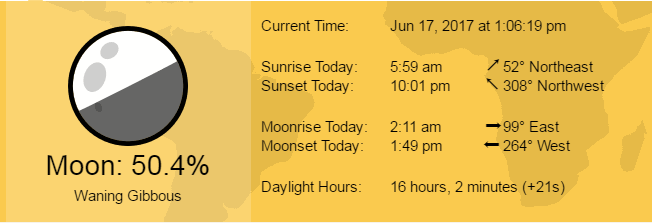
Below is the astronomical information for the race from timeanddate.com
Below is the astronomical information for the race from timeanddate.com