By Doug Schneider
Click on images to enlarge
Click on images to enlarge
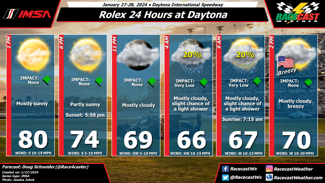 |  |
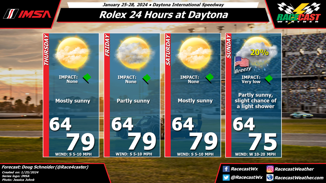
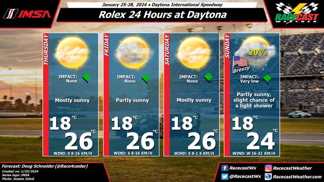
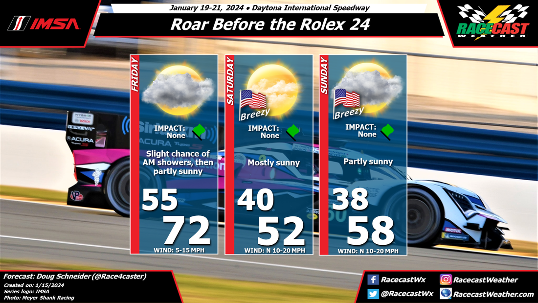
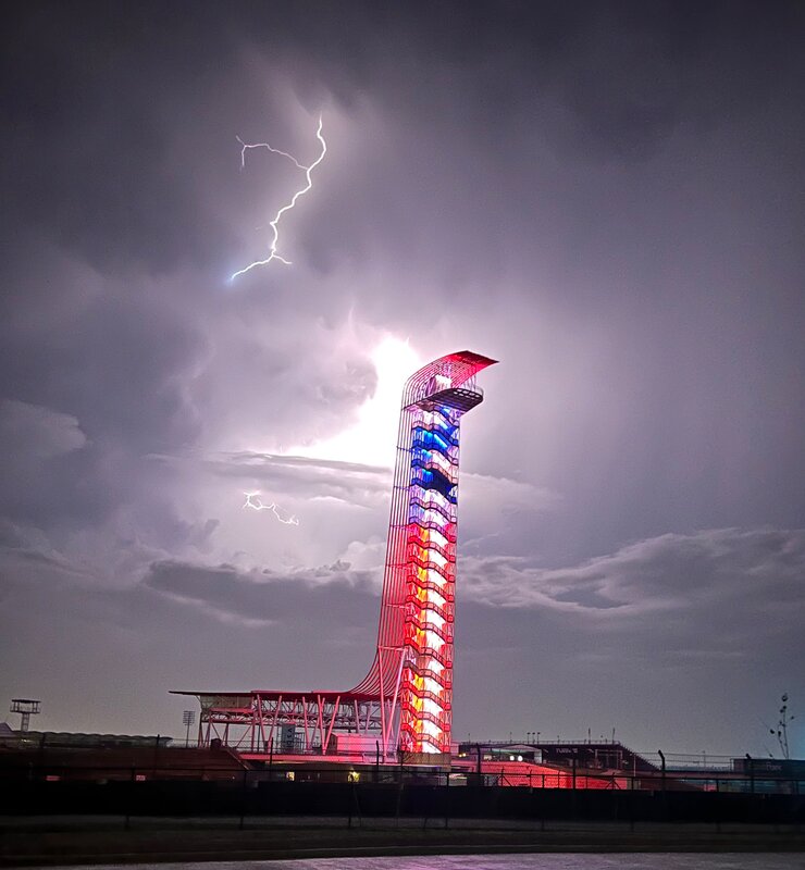
The weather continues to look good for the Rolex 24. Warm temperatures can e expected today, with a high around 80 degrees. Clouds will gradually increase through the afternoon and evening as a cold front approaches from the northwest. This front could squeeze out a few light showers in the pre-dawn to mid morning hours. However, if there are any showers, only a few hundredths of an inch is expected. I don't think this will have a significant impact on the race. I can't entirely rule out lightning in the area, but the chance of it happening at the track is very low. Winds will pick up to 10 to 20 mph in the closing hours of the race, shifting to a west direction behind the cold front.
I'll be posting updates about the weather on our X account - @RacecastWx.
I'll be posting updates about the weather on our X account - @RacecastWx.