The 12 Hours of Sebring is a week from tomorrow, so it's time to start looking at what the general weather pattern will be across Florida for next weekend. Of course, this prognosis is subject to change, and I'll have a more specific forecast for the race in a few days.
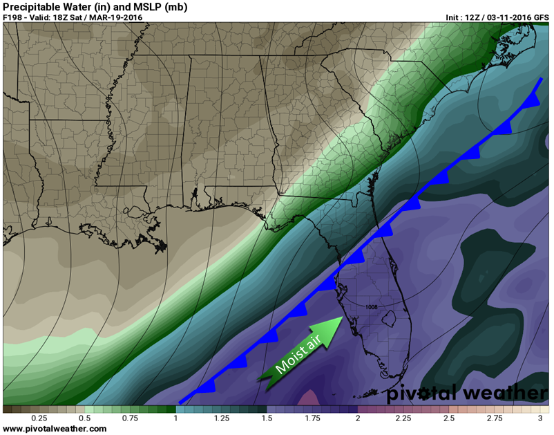
The pattern across Florida next weekend looks pretty wet. How wet varies by which model you look at, but they all agree that the pattern will favor a southwest feed of moist air from the tropics, along with a front moving southward across Florida. This pattern points toward a rainy race weekend.
Here's an image from the GFS model that gives you an idea of what the pattern might look like next Saturday afternoon (2 pm EDT to be exact). It shows precipitable water in the image (how much rain would accumulate if all the moisture were squeezed out of a column of air), and surface pressure in the black lines. I've added the approximate position of a cold front.
Are we looking at another water-logged race like 2015 Petit Le Mans? It's possible, if this pattern verifies. We're still over a week from the race, so hopefully the models will change, but this is what we're looking at right now. Stay tuned.


