By Doug Schneider
The main weather story with the Roar Before the Rolex 24 will be the cold temperatures - at least, cold for Florida. Whenever I say that it will be cold with highs in the 50s and lows in the 30s, people who live outside of Florida laugh and comment on how that's not really cold. But it is well below normal for Daytona.
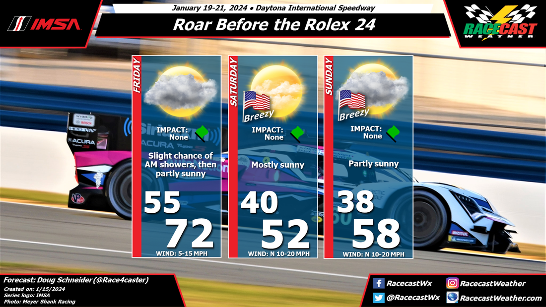
Rain is expected in the area on Thursday and Thursday night. Most of this activity should be gone by the start of the activities on Friday, but there's a small chance that there could be isolated showers in the area. Friday will be partly sunny with nice temperatures in the lower 70s, but then a cold front will cross the area late in the day. This will bring much colder temperatures and breezy conditions for Saturday and Sunday. Gusts up to 25 mph are possible at times, and daytime highs will be in the 50s.
Rain is expected in the area on Thursday and Thursday night. Most of this activity should be gone by the start of the activities on Friday, but there's a small chance that there could be isolated showers in the area. Friday will be partly sunny with nice temperatures in the lower 70s, but then a cold front will cross the area late in the day. This will bring much colder temperatures and breezy conditions for Saturday and Sunday. Gusts up to 25 mph are possible at times, and daytime highs will be in the 50s.