
By Doug Schneider
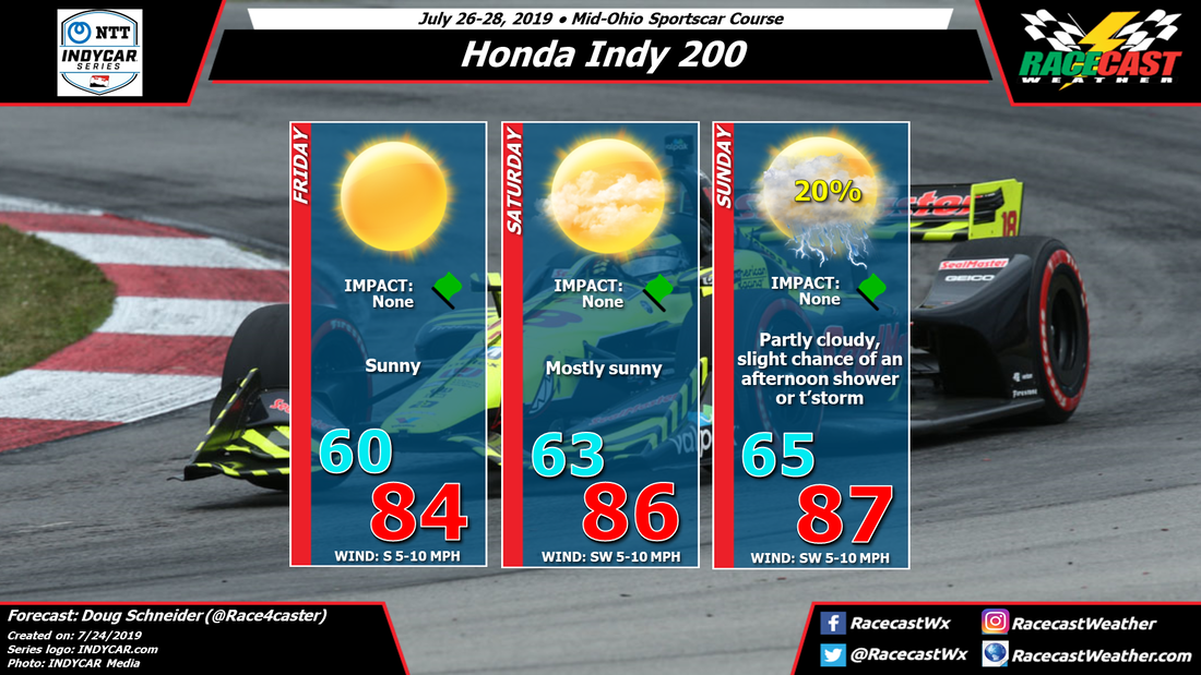
There have been a couple slight changes to the forecast for Mid-Ohio today, but nothing major. It still looks like the weather will be good through the event, with warm temperatures each day, and just a slight chance of an afternoon storm on Sunday that is unlikely to have an impact.
Ohio is currently under a large high pressure ridge that has brought cool and dry air to the region. As I type this Wednesday afternoon, temperatures across central Ohio are in the lower to mid 70s, with low humidity.
Over the next few days, the high pressure ridge will shift east, and a southerly flow will gradually bring more moisture and warmer temperatures to the area. By Friday, highs will be in the mid 80s. Humidity levels should still be fairly low, so it will still feel comfortable. Saturday will continue to trend warmer, with a little higher humidity. I have removed the slight chance of showers that I had in the previous forecast, because the models are trending slower with the increase in moisture.
On Sunday, with moisture continuing to increase and a low pressure system approaching the Great Lakes region from the west, there may be enough instability to allow for isolated showers and thunderstorms in central Ohio during the afternoon. The chance of one of these showers hitting the track is low, just 20%. Because of that low chance, I am keeping the Impact at None. The chance of a dry race (80%) is much higher than the chance of any rain (20%), but I can't rule it out completely. High temperatures Sunday afternoon are expected to reach into the upper 80s, with the humidity making it feel like it's around 90.


