
By Scott Martin.
Here is the latest on the forecast for the Roar Before The Rolex 24 at Daytona. A surface low will be hugging the Alabama and Florida Gulf Coast on the day on Friday and will hang around until an approaching cold front trailing from a low in the northeast US moves through and makes it move. This will keep the skies mostly cloudy to cloudy throughout the weekend.
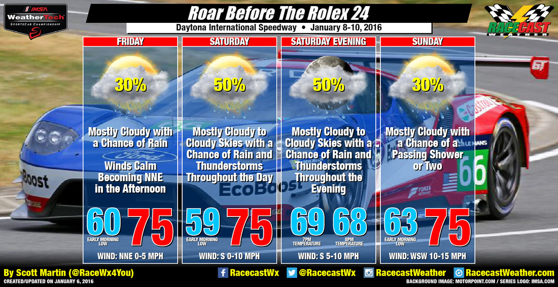
Friday, with the surface low centered off to the west, the flow will pull moisture from the Atlantic and into the area. At the time there is not enough instability to fire off any thunderstorms, but I do believe that a shower could be possible at any time during the day. To start off the day, temperatures will be in the lower 60s, and will reach a high in the middle 70s by the afternoon. Chance of rain is 30%.
The surface low will be pushed along by the approaching cold front that I mentioned earlier, and this will increase the rain and thunderstorm chances for the day and evening on Saturday. Early morning lows will be near 60, with daytime highs in the middle 70s. By the end of evening practice, temps will have fallen back down to the upper 60s. Chance of rain is 50%.
As the low moves southeast and away from the area on Sunday, rain chances will start to decrease but will remain in the forecast. I do not believe there will be enough instability to have any thunder. Early morning lows will be in the lower to middle 60s, with daytime highs topping out in the middle 70s. Chance of rain is 30%.
Be sure to follow all of our social media feeds (Twitter, Facebook, Instagram) and my Twitter feed @RaceWx4You for the latest updates. We will also have radar up and running on our website. Just click on the radar link at the top of the page. Have a great week, and lets get racing!


