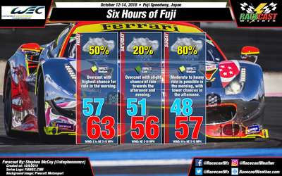
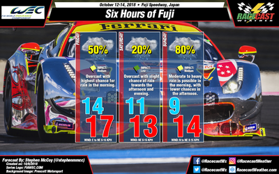
The pattern in the upper levels looks to stay relatively consistent with the previous forecast with a longwave trough moving through on Friday with a shortwave trough following close behind, and conditions returning to a more zonal flow on Sunday. At the surface, the cold front from a low pressure system to the north is expected to linger in the area on Friday, with a chance for rain concentrated in the morning and possibly early afternoon. Due to high pressure to the east, winds will be from the east to northeast, though with a slightly stronger pressure gradient winds will be around 5-10 mph (8-16 kph).
An area of low pressure is expected to form to the south of Japan, ahead of the shortwave trough, and could bring a slight chance of showers to the region Saturday afternoon or evening. The system is expected to track to the northwest, approaching the southern coast overnight Saturday into Sunday morning before turning east towards the North Pacific Ocean. There is a likely chance of rain during this time frame, with chances decreasing as the day progresses. Winds will continue from the northeast as winds wrap cyclonically around the low.
High amounts of relative humidity in the low levels will keep conditions mostly cloudy to overcast for most of the forecast period. A shift in low level winds to the north on Sunday afternoon is expected to erode some of the cloud cover into the evening hours.


