
By Doug Schneider
Not much has changed in the forecast for Super Sebring weekend, but my confidence in the forecast is increasing and some details are coming into better focus as the models have remained consistent regarding a cold frontal passage that could bring some scattered showers to Sebring Raceway during the 12 Hours.
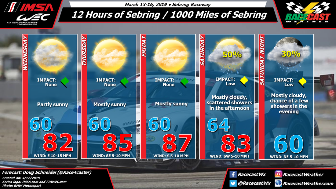
High pressure from the surface through the midlevels of the atmosphere will provide nice weather for Wednesday through Friday. Temperatures will be warm each afternoon but the humidity levels will be comfortable. Winds will be shifting from the east on Wednesday to southeast on Thursday to southerly on Friday as the surface high pressure center tracks east.
A cold front is still on track to pass through central Florida on Saturday, and with it will come a chance of showers. The time period of potential showers looks to be from noon through the end of the race. But it will not be raining that entire time period. As I mentioned in my last post, this does not look like a prolonged moderate to heavy rain like what occurred at Daytona at all. The coverage of showers appears to be more scattered, which means that it is possible that the track could avoid seeing any rain at all. If a shower does pass over the track, it should not last for a very long time - the on/off nature of the showers should allow for any standing water on the track to run off.
While forecasting rain amounts this far out is difficult, my best estimate for rain amounts at this time is in the neighborhood of a tenth to a quarter inch of rain. Again, it is very possible that no rain falls at the track, which is why I have the chance of rain at 50% in the forecast. It is also possible that multiple showers cross over the track repeatedly and dump up to a half inch of rain. But as of today, I think the tenth to a quarter inch range is the most likely scenario.
Stay tuned for more updates over the next few days as we get into the time period where some higher resolution models can help provide more details on the timing and amounts of rain on Saturday.
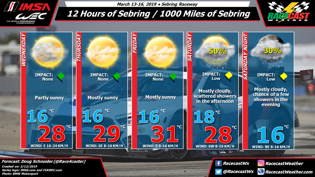


