
By: Stephen McCoy
As was expected from the previous forecast update, Saturday's chance for showers has gone to the wayside and a dry weekend awaits at the ADAC TOTAL 24 Hours of Nürburgring.
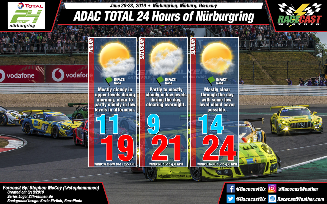
The weather pattern for Friday will have a surface high pressure system centered over the northwest of France as it tracks to the northeast towards Scandinavia. The anti-cyclonic rotation around the high will cause surface winds from the west to northeast. Upper level winds from the southwest will bring some moisture to the region in the morning ahead of the axis of a shortwave trough, resulting in some cloudy conditions early. However, after the center of the axis passes through, upper level winds will shift to the northwest with cooler, drier air approaching. Low level winds from the west to northwest are expected to transport low amounts of moisture off the English Channel, resulting in partly cloudy conditions in the afternoon. Daytime heating from less cloud cover will result in temperatures slightly warmer than those seen on Thursday.
In the last forecast update, I mentioned a low pressure system forming off the west coast of Italy. The models are now in agreement that the system will track eastward, instead of north or northeastward. Because of this, any precipitation with the system will stay mostly concentrated over Switzerland and northern Italy, with some showers in southern Germany. However, enough moisture will be around the system to where mostly cloudy conditions will be likely for most of Saturday, concentrated mostly in the lower levels. As the low moves towards eastern Europe, cloud cover will begin to decrease with clear conditions eventually occurring overnight. The aforementioned high pressure system is anticipated over the Benelux region during the day which will cause winds from the north overnight and into the morning and northeast for the rest of the day. Winds moving over land in the afternoon will result in warmer temperatures. Some windier conditions are possible during the day as low level winds will be from the same direction as the surface winds.
On Sunday, the high pressure system, now located over Scandinavia, will force winds from the east to northeast over the region. The surface winds will bring warmer air to the region as the land warms quickly during the day. This, coupled with low amount of cloud cover during the day, will make Sunday the warmest day of the weekend. Windier conditions are possible again as winds in the low levels are from the same direction as at the surface.
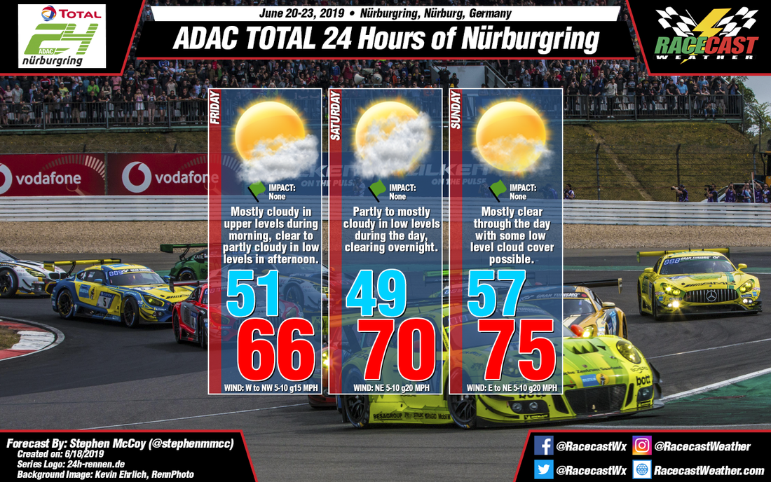


