
By Doug Schneider
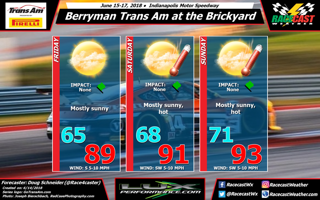
I've made a few changes to the forecast for Trans Am at IMS with today's update, but the general weather pattern isn't significantly different from what I was seeing on Monday. A large high pressure ridge building over the region is expected to provide dry and hot conditions through the weekend.
The slight chance of rain that was forecast on Friday is now gone, as it looks like any thunderstorm activity on Friday will stay to the west and north of the Speedway during the day.
Low level moisture will be increasing on Saturday, which means more instability, but the building high pressure ridge in the mid and upper levels will suppress convection over central Indiana. There will probably be some thunderstorms in northern Indiana that will track into western Ohio, but it is not expected to reach the Speedway. There is a little uncertainty about this, but I feel confident enough to keep showers out of the forecast for Saturday. With the ridge getting stronger, temperatures will be getting warmer, with a high in the lower 90s.
Heat and humidity will continue to slowly rise for Sunday as the ridge aloft will continue to strengthen. Sunscreen and plenty of water will be needed if you're going to be at the Speedway this weekend.


