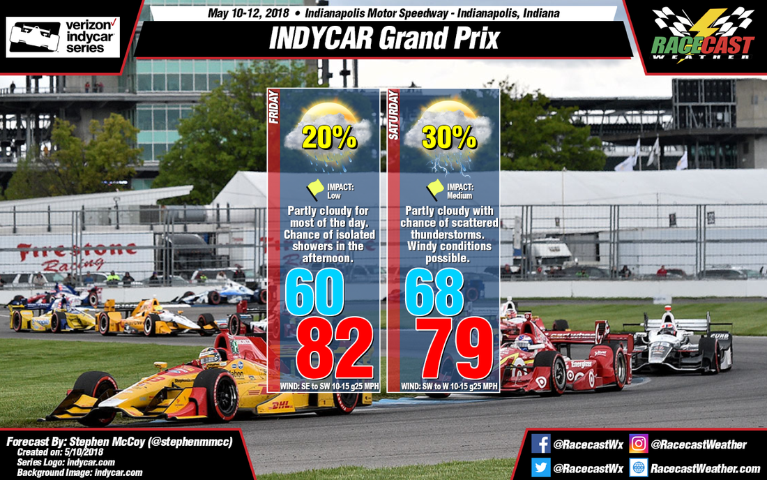
Initial winds in the morning will be out of the northeast and east, bringing some cooler temperatures before swinging to the south and southwest with the approach from a warm front. Surface winds and winds in the lower portion of the atmosphere are expected to align in the same direction, causing winds around 15-20 mph with some stronger gusts approaching 25-30 mph. The warm front is expected to move through central Indiana mid-day, causing rain to the North and West of Indianapolis. However, depending on exact placement of the front in the afternoon and evening, coupled with daytime heating, it could bring a few isolated showers into central Indiana and has a low chance of affecting on track activities.
With the passage of the warm front, expect warmer temperatures in the upper 60’s in the morning. As the day progresses, winds continuing from the south and southwest will bring temperatures into the upper 70’s. Wind speeds are expected to remain constant through the forecast period at around 10-15 mph with gusts at 25-30 mph. The Storm Prediction Center currently has a Marginal Risk of storms (level 1 of 5) stretching from Iowa through West Virginia and includes much of central Indiana. There is a chance of scattered thunderstorms that could affect the races held in the early afternoon. Look for a more definitive outlook in the next update.


