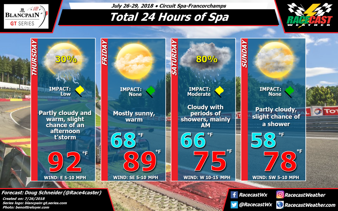
This afternoon at Spa-Francorchamps, temperatures will be quite warm, reaching well into the lower 90s F/lower 30s C. With this heating will come some instability that will allow for scattered showers and thunderstorms to develop in the area. Whether one of them will hit the circuit remains to be seen, but I'd put the chances of that at 30%. If it does, there may be lightning and heavy rain for a brief period.
Friday looks more stable with a little more dry air through the lower and midlevels of the atmosphere. This should prevent afternoon storms from developing. Temperatures will still be quite warm, with highs near 90 F/32 C.
Rain will start to spread into the area from the west on Saturday morning as a cold front and a deep upper level trough swing through the area. I expect that the onset of rain will occur around 7 am CEST, give or take a couple hours either way. Periods of rain showers will continue through the morning and the early afternoon, with rain diminishing in the afternoon as the upper trough moves east. The most likely time frame for the majority of the rain will be between 8 am and 2 pm, with a few light showers possible after 2 pm until 8 pm. The total amount of rain to expect on Saturday will be between 0.15 and 0.3 inches, or between 4 and 8 mm. Temperatures will be much cooler behind the front with cloudy skies all day, only reaching the mid 70s F/ mid 20s C.
Sunday should be a much nicer day for the finish of the race. It will be cool overnight, with a low in the upper 50s F/mid teens C, then partly cloudy skies and temperatures in the upper 70s F/mid 20s C during the day.


