
By: Stephen McCoy
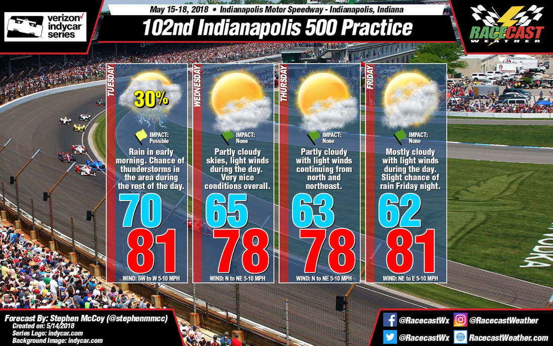
It’s finally time for those two weeks of speed around Indianapolis Motor Speedway. Festivities kick off this week with the first practice sessions. Overall, conditions look much favorable than last year’s first practice sessions. Tuesday is the main concern for possible delay of on track activities.
Rain will move in during the early morning hours on Tuesday; after sunrise though, precipitation probabilities begin to get tricky. Once again, the probability of rain is mostly dependent on the placement of a front, this time being a cold front extending from a low pressure system over the northeastern United States. An area of divergence in the upper levels of the atmosphere from the entrance region of a jet streak over central Indiana could contribute to a chance for scattered thunderstorms over the region. There is some disagreement among the models as to when the passage of the cold front occurs, especially as we get closer to Tuesday’s action. The most likely chance of rain is expected in the early and mid-afternoon, and could affect the second practice session. The low temperature for Tuesday will be around 70F with a high temperature in the low 80’s with the heat index into the mid 80’s. Expect light winds out of the southwest and west until the frontal passage shifts the winds to the north.
As opposed to Tuesday, the rest of the week has very favorable conditions. As the cold front moves further east, high pressure will move into the region along with a small split-flow blocking pattern in the upper levels of the atmosphere. Light winds from the north and northeast will bring drier air and some pleasant temperatures in the upper 70’s for Wednesday. Conditions will remain about the same for Thursday. Friday sees a slight breakup of the blocking pattern and is expected to bring a slight more cloud cover during the day, along with a slight shift in winds to the east. A chance of rain is expected Friday night after on track activities are completed.


