
By: Stephen McCoy
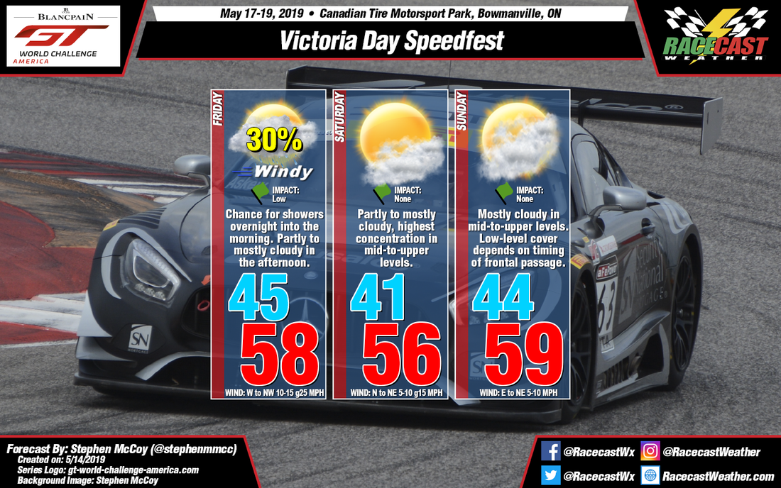
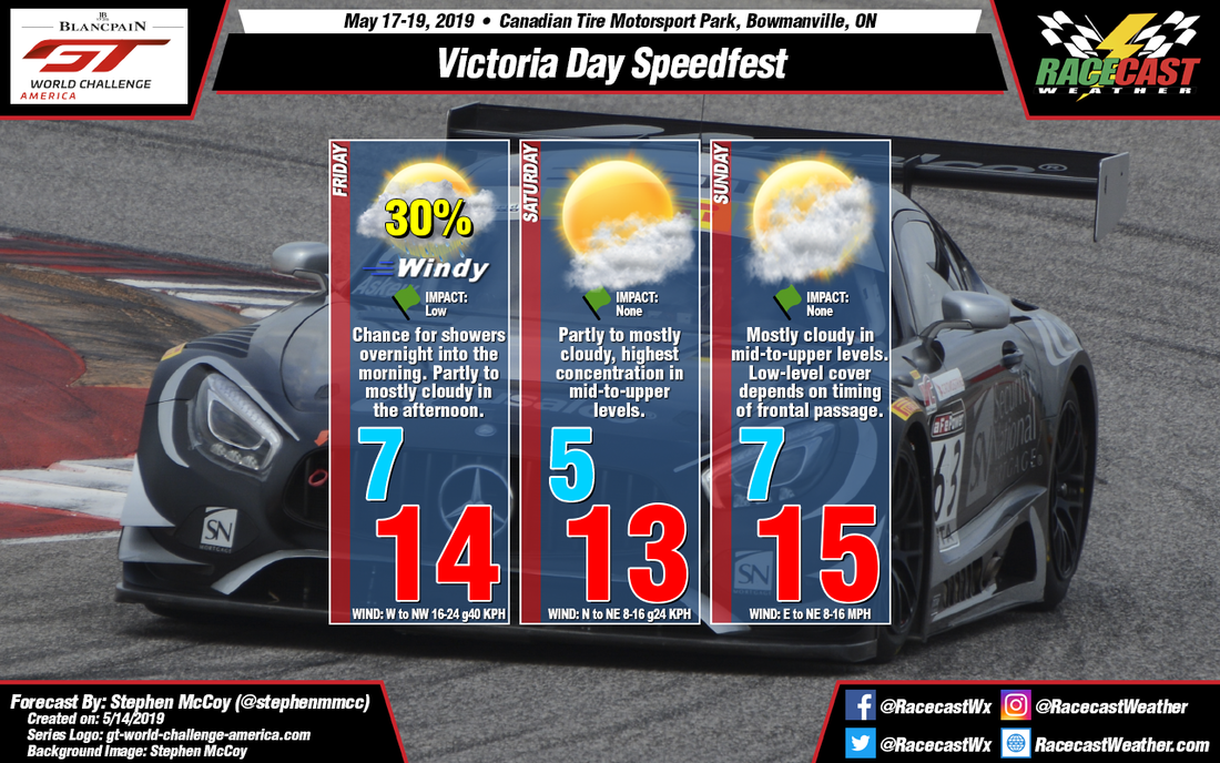
During the day on Thursday, a localized surface low pressure system is expected to be present over southwestern Ontario, moving eastward towards the Atlantic through the weekend. The system will be formed ahead of an upper level shortwave trough Tuesday evening into Wednesday over southern Alberta, CN/Montana, US. A cold front extending to the south of the low will approach the region overnight Thursday or into Friday morning. Timing of the frontal passage is being somewhat disputed among the models. An earlier passage will have winds from the northwest that will cool temperatures to slightly below average. However, a later passage will allow temperatures to warm from southerly winds ahead of the front before ultimately shifting to the northwest after the front passes. Regardless, there is a chance for showers ahead of the front, which may or may not affect on-track sessions, depending on when the cold front passes. Conditions are expected to be overcast to mostly cloudy ahead of the front and will slowly clear through the day as winds aloft will bring drier air to the region from the northwest.
Surface winds will continue from the north to northwest on Saturday as high pressure builds in to the northwest of the region; slightly cooler temperatures are expected as a result. A mid-to-upper level shortwave trough centered over Montana/Colorado in the US and extending into Mexico will surge moisture northwards during the day. A mid-to-upper level ridge will be present over the southeastern US. The flow around the ridge will ultimately allow the moisture being transported from the trough to move over southern Ontario which will result in partly to mostly cloudy conditions during the day, mainly concentrated in the mid-to-upper levels.
On Sunday, a surface low pressure system is expected between the northern Great Plains and the Midwest in the US. A warm front will extend eastward from this low, approaching southern Ontario from the south. Once again, the models are disagreeing as to when the front will approach the region. An earlier passage means slightly warmer temperatures for the day with winds from the south, while a later passage means temperatures will be fairly constant with the rest of the weekend with winds from the east to northeast. Conditions in the mid-to-upper levels will be similar to Saturday. More low-level clouds will be present ahead of the front and clear conditions will occur behind the front.


