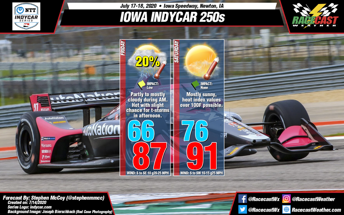
A slight chance for isolated to scattered showers is also present for Friday afternoon due to the large influx of moisture over the region. Current forecast model output suggests thunderstorms in the region during the afternoon time period, though there is uncertainty on the specifics of when/where individual storms will be. Current impacts for track activities is low, however a passing storm would likely delay or possibly cancel qualifying.
During Saturday, the aforementioned surface low pressure system is expected to move eastward across the Great Lakes region, with a cold front trailing to the southwest of the center. Throughout Saturday, the front will remain to the northwest of Iowa, resulting in surface winds continuing from the south. Warmer temperatures are then expected for Saturday, with a low in the mid 70's and a high in the low 90's. Dew point temperatures in the mid to upper 70's will cause heat index values to approach triple digits in the afternoon, and could last into the evening, including the start of Saturday's race. Adding insult to injury, little cloud cover is anticipated during the day, meaning that health risks such as sunstroke, heat cramps, and heat exhaustion are a possibility.


