
By: Stephen McCoy
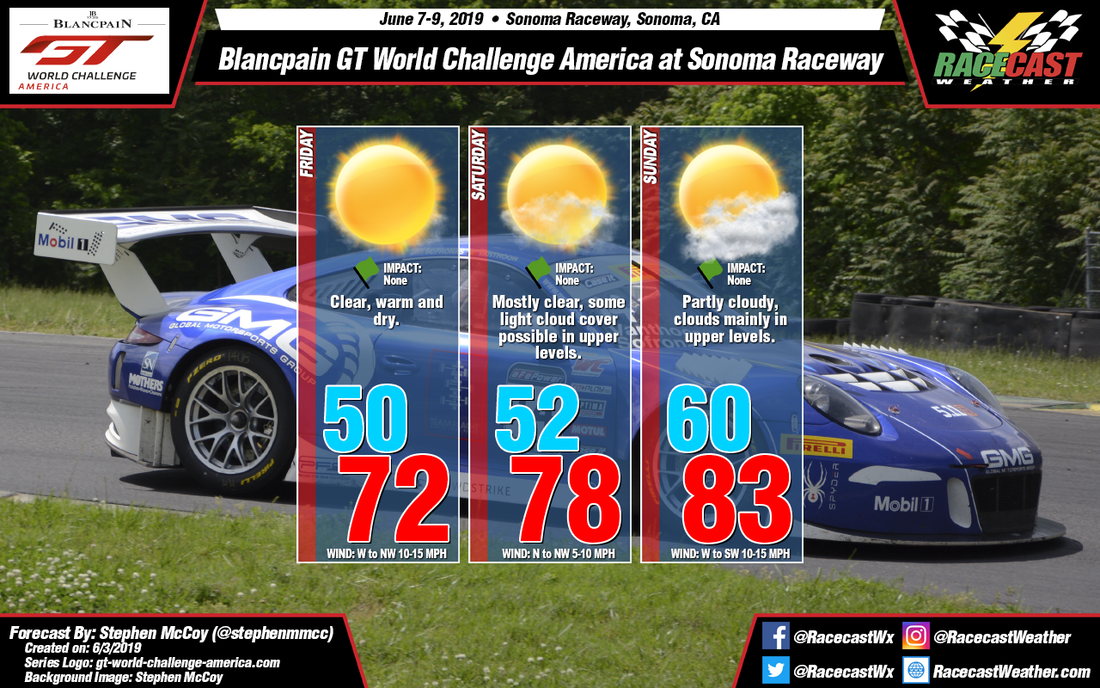
Typical late-spring California weather awaits for this weekend at Sonoma Raceway. After a few days in the mid-80's to start the week, temperatures will cool to the 70's before a low 80 degree Sunday. Full sun to partly cloudy conditions are likely with no precipitation expected.
An upper level trough is expected to move through the Pacific Northwest during the day on Friday, with the southern tip of the trough moving over the Bay Area early Friday morning. Upper level winds behind the axis of the trough will be from the northwest bringing cooler, drier air to the region. Winds in the low-to-mid levels will follow this pattern, with the result being clear conditions throughout the day. An area of high pressure at the surface will build in over the Pacific as an upper level ridge moves in behind the trough. The high is expected to bring temperatures around 10-15 °F cooler than temperatures earlier in the week, beginning Thursday as winds shift to the northwest.
Similar conditions are expected for Saturday, though temperatures will be slightly warmer due to winds from the north to northwest moving over land instead of the cooler ocean waters; surface wind speeds will also be slightly lower due to this reason. In the upper levels, winds are expected from the west to southwest as a ridge moves into the Baja California region. These winds will help transport moisture from the tropics, resulting in some light upper level cloud cover during the day. Upper level winds continuing from the southwest will cause partly cloudy conditions over the region, while surface winds from the west to southwest will result in the warmest temperatures of the weekend on Sunday.


