By: Stephen McCoy
It seems that no matter what time of year the Spa 24 occurs, the weather stays much the same. This time, it's the result of two surface lows moving through the region one after the other to round out the week.
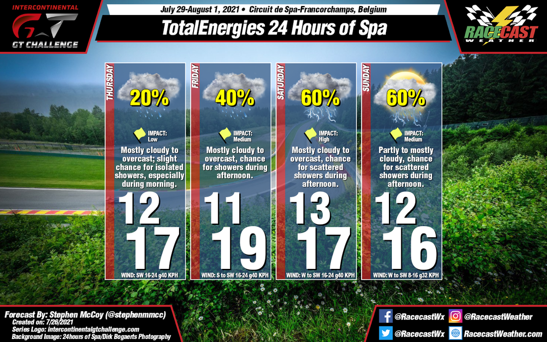
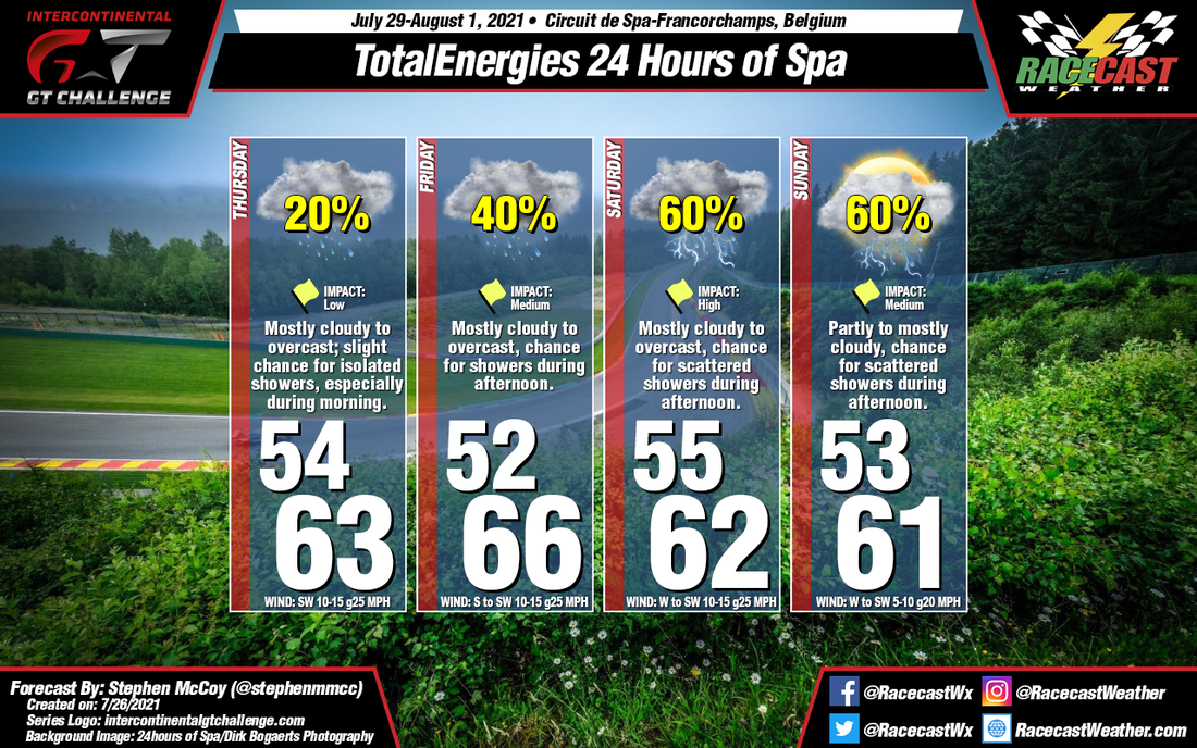
Through mid-week, a surface low pressure system will develop over the British Isles ahead of an upper level pressure trough. Into Thursday, the system will be centered over the North Sea, with winds over Belgium from the Southwest. Winds in the upper levels are expected from the same direction, with moisture mainly off the Atlantic resulting in mostly cloudy to overcast skies. A slight chance for isolated showers will be present, most likely int he morning when temperatures are at their coolest. The low will push to the Northeast into Friday, though winds will continue from the South/Southwest through the day, causing slightly warmer conditions than Thursday, but with an increased chance for precipitation, especially during the afternoon.
Late Thursday into early Friday, a second upper level shortwave trough will cause a surface low pressure system to develop over the Atlantic Ocean, which will approach mainland Europe late Friday into Saturday. The low will continue in an East-to-Northeasterly direction through the weekend, bringing a chance for showers and thunderstorms to the region as is passes by. Moisture wrapping around the low from the South will result in mostly cloudy to overcast conditions through much of Saturday with a slight reprieve Sunday morning.