Last Saturday's IndyCar qualifying session for the Grand Prix of NOLA was delayed and eventually canceled due to what officials called "severe weather". If you were on Twitter as I was during this time, you were probably well aware of the widespread head-scratching that was going on about this decision, not only by many fans who were at the track, but by myself and other meteorologists who were watching the situation with a close eye on the weather from afar.
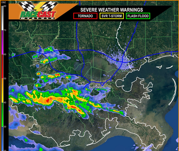
| The session was originally scheduled to begin around 4:15 pm CDT, but was delayed by IndyCar officials. The image to the right is a look at the Racecast Weather live radar around the time that the call was made to delay the session (click to enlarge). There was some light rain over the track in Avondale at the time, but most of the heavier showers were located well to the south and west of the track. The motion of these showers was variable and very slow, with a slight drift to the north. It was clear that the situation was only going to get worse with time, but there was a window of opportunity to get qualifying done before the heavier rain reached the track. The closest lightning strike at this time was approximately 25 miles to the west. It was also clear that once the rain hit, it was going to stick around for a while since it was moving so slowly. |
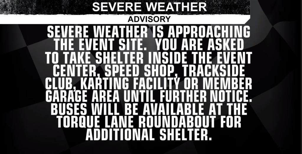
For a moment, put aside the forecast accuracy of whether heavy rain and lightning was imminent or not (it would be nearly another hour after this announcement was made that lightning did occur within 5 miles of the track and qualifying had to be red flagged). Let's just look at the announcement itself. I was shocked and disappointed when I saw this. It was careless, irresponsible, and possibly dangerous to make an announcement like this in this particular situation. Why? Simply put, it's crying wolf. There was no official severe thunderstorm warning in effect for the track, or anywhere in the state of Louisiana at the time.
In meteorology, and specifically the National Weather Service (for who I am employed), there is a very specific definition of what constitutes severe weather. The criteria are wind speeds 58 mph or greater, and/or hail one inch or more in diameter. Anthing less than those criteria, and the storm is not severe. It may be "significant", but it is not "severe". Notice that lightning, no matter how frequent, is not criteria for a severe thunderstorm! Neither is heavy rain. The National Weather Service is the exclusive source of severe thunderstorm warnings in order to prevent any conflicting information from going out to the public.
"Big deal, better safe than sorry!", you might say. Why does it matter? It matters because raising the alarm for severe weather when none is expected to occur can lead to complacency the next time a true severe storm does threaten. It suggests that "severe weather" really isn't something to take seriously, and people may not take action the next time a real severe thunderstorm warning is issued. Severe thunderstorm warnings from the National Weather Service should be taken seriously, as they are issued for storms that are potentially life-threatening or can cause significant damage. Meteorologists work very hard to communicate a clear message to the public when it comes to threatening weather, and careless statements like this one undermine that message.
Instead of scaring people into action with a false and confusing claim of severe weather, why not tell the public exactly what they can expect to occur? A better announcement would have said "Lightning Advisory: Lightning and heavy rain are approaching the event site". This would have been more accurate and just as effective to move people to shelter.
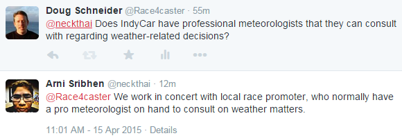
Mistakes like this one can be easily avoided with the right information at hand. If the qualifying session had started at the scheduled time of 4:15 pm CDT, there's no doubt that it could have been completed in its entirety before the storms arrived around 5:15 pm CDT. Perhaps you might say "hindsight is 20/20", but it was obvious to myself and other meteorologists as the situation was unfolding that the delay was a bad call. It's apparent that IndyCar does not have a trained meteorologist available to help make weather-related decisions. If anyone at IndyCar is reading this, Scott and I would be thrilled to offer our services to help the series make better decisions in the future. See the Contact link at the top of the page.
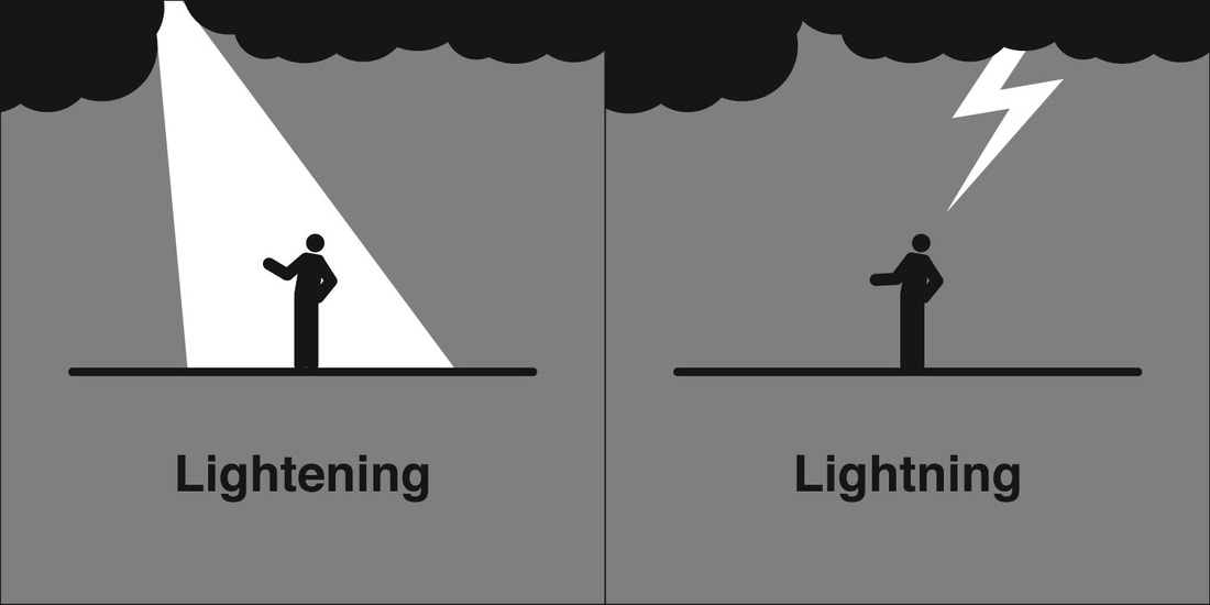
Another careless mistake I encountered many times on Twitter during the NOLA qualifying session that requires correction: the proper spelling of lightning. Here's a handy graphic to help you remember.
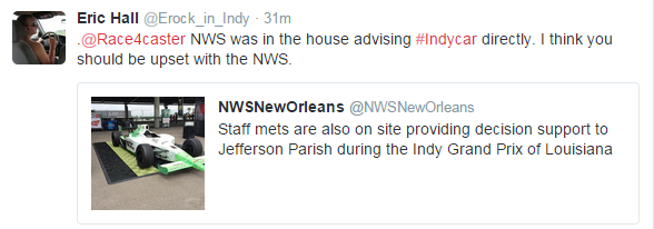
I've done on-site weather support for NASCAR races at Bristol Motor Speedway. My role there is to provide weather information to local emergency management officials, not to NASCAR. NASCAR has their own meterologists that they pay to provide information to them exclusively, and it is NWS policy for me not to give weather briefings directly to NASCAR. The reasoning behind this policy is that the NWS does not want to step on the toes of private sector meteorologists who get paid to provide weather information.
The wording in the tweet by NWS New Orleans suggests that this was the case for the GP of NOLA. The tweet does not say they were providing decision support to IndyCar, it says they were providing support to Jefferson County Parish. Again, I don't know if they communicated with IndyCar or not, but if they did, it was against NWS policy. I don't know what access to weather information IndyCar officials have, but if they're paying for it, they're getting ripped off.
Another tweet came from Mitch Robinson about the "Severe Weather" advisory statement:

