
By Scott Martin.
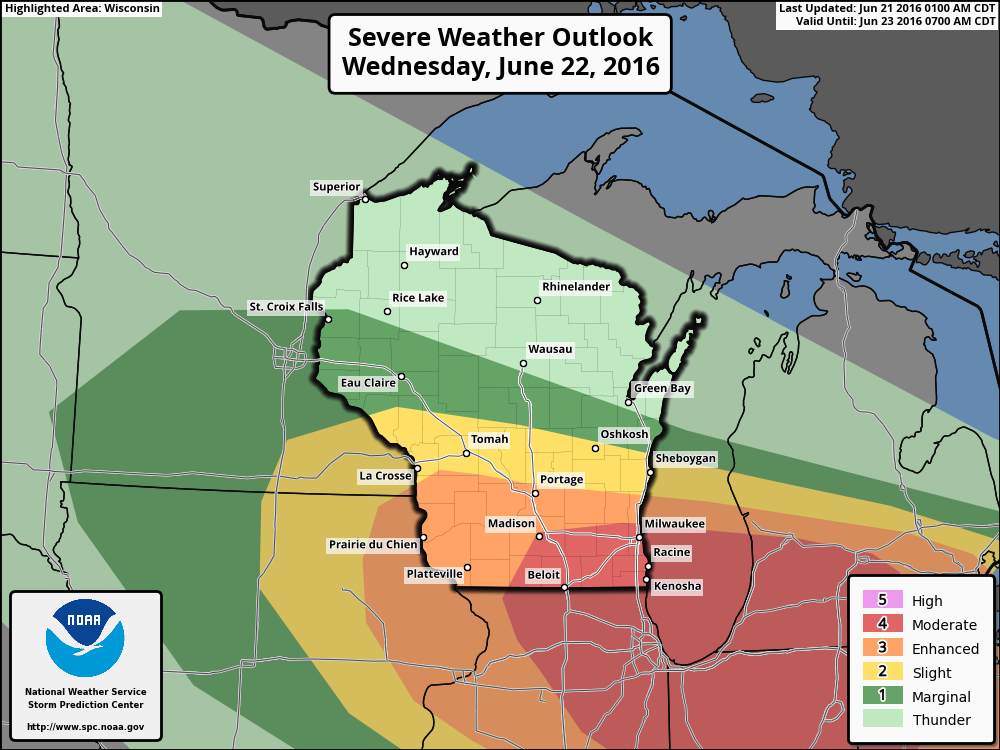
As you can see by the image above, over half of the state has been placed in some risk for severe storms for Wednesday. Road America, along with Plymouth and Elkhart Lake has been placed under a "slight risk" for severe weather throughout the day.
There may be a few storms that will move through the area during the morning hours, and these have the possibility to be severe, with large hail being the main threat. The main risk for severe weather will come later in the day during the late afternoon and evening hours. With a surface low and warm front being close by, developing storms should quickly become severe. All modes of severe weather will be possible: tornadoes, large hail, damaging winds and heavy rainfall.
There is still some uncertainty on the placement of these storms tomorrow evening. If there is a 25 mile jog to the north with these storms, the severe threat could increase. If they are 25 miles farther to the south, the severe threat will be less.
I'll have an update later tonight on the conditions expected tomorrow. I'll have radar on the site running that will have lightning data and storm warnings active. Have your source of weather information handy, as tomorrow will be a busy day in Wisconsin.


