
By Doug Schneider
The chance of rain at Pikes Peak is climbing as we approach the weekend. The weather pattern that I described in my original forecast still looks on track, and with better model agreement and consistency, my confidence that there will be some showers and thunderstorms has increased.
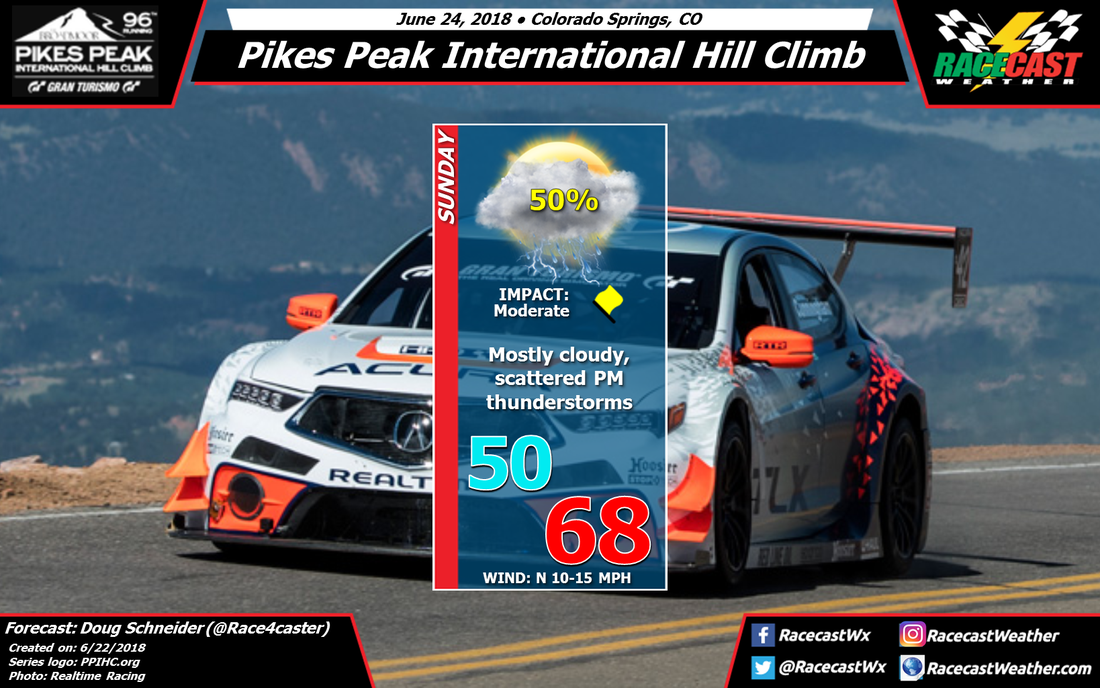
A mid to upper level low pressure area will be tracking across northern Utah and the Colorado/Wyoming border on Saturday night and Sunday. At the surface, a low pressure center will be taking shape in the Plains of eastern Colorado. These features will help draw some moisture northward and into the Front Range of the Rockies. The moist air rising up and over the mountains, combined with instability beneath the upper level trough, will lead to the development of afternoon showers and thunderstorms in the Colorado Springs and Pikes Peak area.
The coverage of showers and thunderstorms will likely be scattered, so the chance of one affecting the hill climb is about 50%. If a storm does hit the track, it could cause some delays, and lightning will be a threat. The storms will be capable of dropping a good amount of rain in a short period of time, perhaps around a half inch. The best estimate for the timing window for storms is between noon and 4 pm local time.
With the complex terrain of the Front Range, and the scattered coverage of storms, hopefully the storms can avoid the hill climb. But if you're heading to the event, it's best to be prepared for rain and lightning. Know where to find shelter when thunder is heard.


