
By Scott Martin
SATURDAY
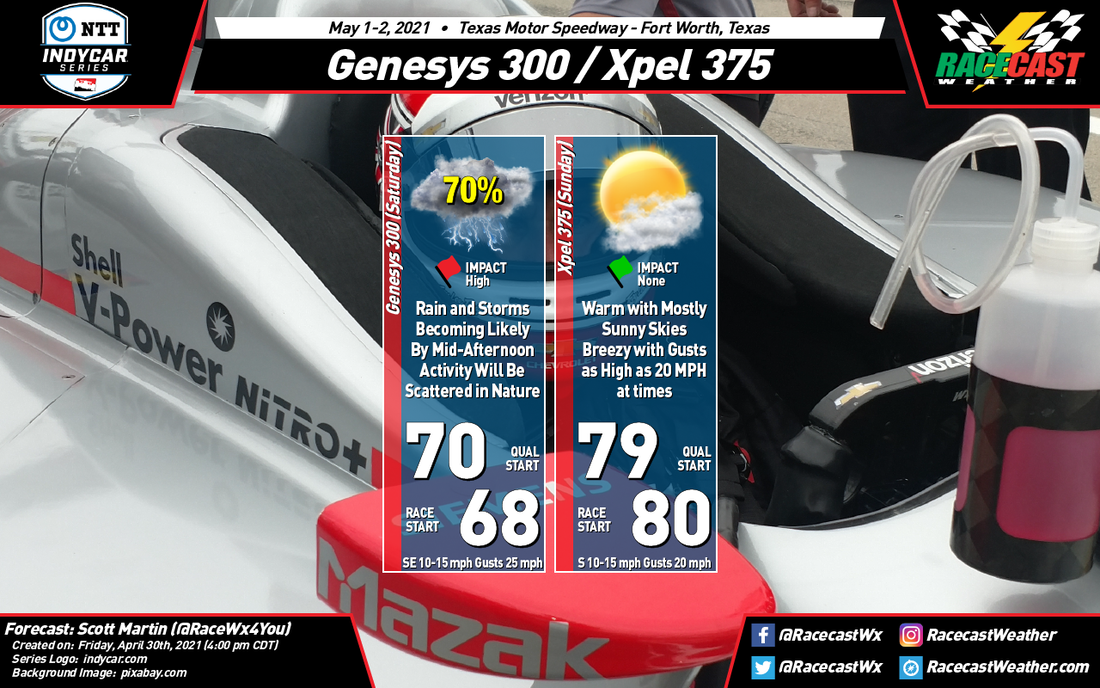
It looks like there is a drastic change to be made to the forecast as an active pattern has set up over portions of the Lone Star State and into the southeastern US. A surface low has set up shop over the southern portions of Texas that will bring showers and thunderstorms to the area on Saturday and Saturday evening. Here is what I have for Saturday’s forecast:
It looks like there is a drastic change to be made to the forecast as an active pattern has set up over portions of the Lone Star State and into the southeastern US. A surface low has set up shop over the southern portions of Texas that will bring showers and thunderstorms to the area on Saturday and Saturday evening. Here is what I have for Saturday’s forecast:
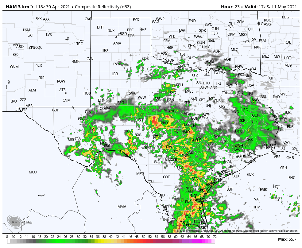
Simulated radar valid at 12 pm CDT Saturday.
Practice 1 (11:30 am to 1:00 pm CDT): There may be a chance for this session to stay dry as showers look to have not made it far enough north on this latest model run. Unfortunately, the activity will be moving northward and will eventually make it to the track. If it does stay dry, skies will be mostly cloudy to completely overcast with winds out of the southeast at 10-15 mph with gusts up to 25 mph possible. It will be around 68 degrees to start the session and rise to around 70 degrees by the end. Dewpoints will be in the mid-60s. Chance of rain will be around 50%.
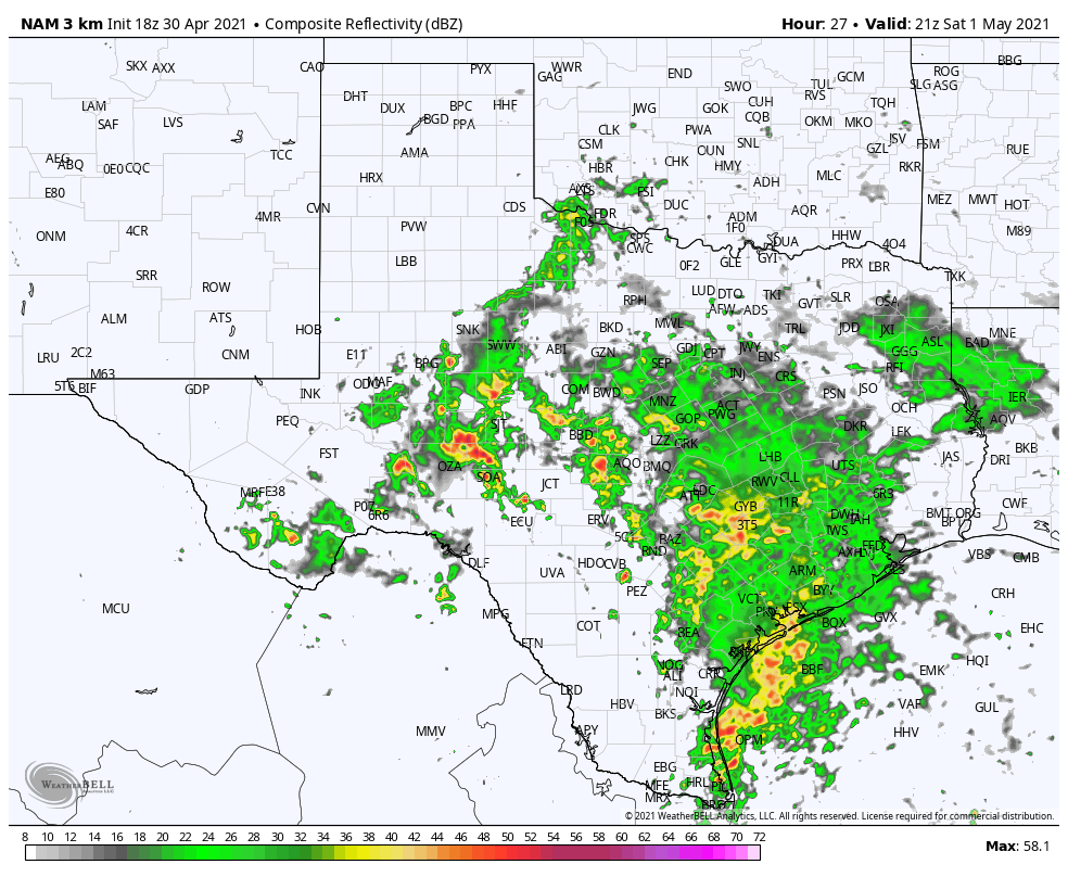
Simulated radar valid at 4 pm CDT Saturday.
Qualifying (3:00 pm to 4:00 pm CDT): As we look ahead to qualifying, the rainfall looks to be starting to move into the area and showers and thunderstorms may begin just before or during the session. Activity continues to look to be scattered at this point, so there is a chance that it may stay dry through the end of the session. However, rain chances will have climbed to over 60% with lightning possible. The temperatures will be hovering around or in between 70 and 72 degrees and winds will continue to be breezy out of the southeast at 10-15 mph with gusts up to 25 mph possible. Dewpoints will be in the mid-60s.
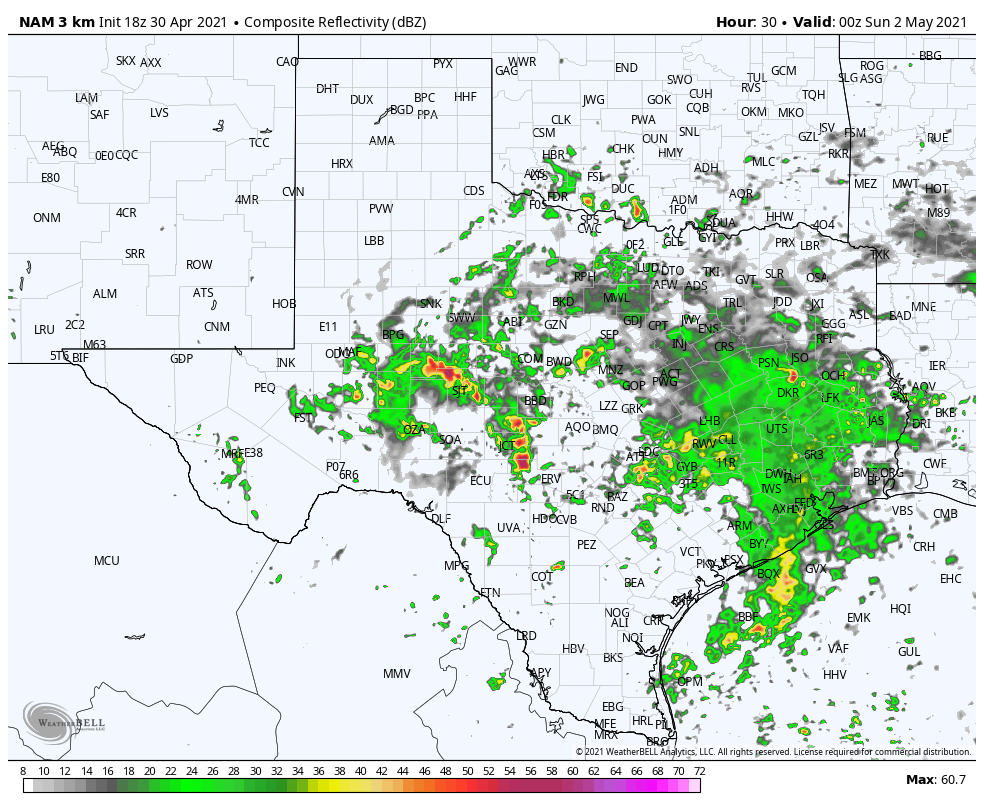
Simulated radar valid at 7 pm CDT Saturday.
Genesys 300 (6:30 pm to 8:45 pm CDT): As we get to race time, the shower and thunderstorm activity continues to be scattered in nature and will continue to be moving northward across the area; however, coverage of the rainfall will be dissipating somewhat. Unfortunately, there is no racing in the rain on an oval. Rain chances will start off around 70% but will slowly drop to around 60% by the end of the allotted time to complete the race. Lightning will be likely with the activity. The temperature will hover around 68 degrees throughout and winds will actually start to slowly decrease from 10-15 mph to 5-10 mph out of the southeast. Dewpoints will remain in the mid-60s.
SUNDAY
Fortunately, Sunday looks to be a much better day at the track as the latest model runs have the rain out of the area by the time we get to the afternoon and evening hours. Here is what I have for Sunday’s forecast:
Qualifying (3:00 pm to 4:00 pm CDT): Skies will be clearing out, and we should have a decent bit of sunshine. Temperatures will be around 80 degrees throughout the session with winds out of the south at 10-15 mph with gusts up to 20 mph possible. Dewpoints will be rising throughout the rest of the day, but will remain in the mid-60sfor this session.
Xpel 375 (4:10 pm to 6:15 pm CDT): Skies will continue the clearing process and will be mostly sunny as we start to head toward sunset. It will continue to stay around 80 degrees throughout the race and winds will continue to be out of the south at 10-15 mph with gusts up to 20 mph possible. Dewpoints will be in the upper 60s.
Radar will be up and running throughout the weekend, just click on the radar tab at the top of the page.


