THURSDAY (8:00AM - 5:00PM CDT)
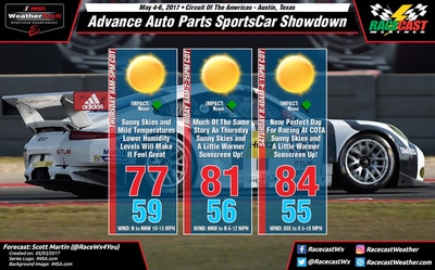
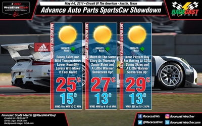
At 8:00AM, skies will be mainly clear for the beginning of the on-track activities, and temperatures will start off at or near 60 degrees. With the system moving out a little faster on Wednesday evening, this will allow the winds to be a little calmer as the cold front will be further away. Skies will be sunny, no rain, and the afternoon high in the upper 70s, around 77 degrees. Winds will be out of the north to north-northwest at 10-15 MPH.
FRIDAY (8:00AM - 7:25PM CDT)
Winds will be much calmer throughout the day on Friday, and skies will be absolutely clear. 8:00AM temperatures will start off in the mid 50s, around 56 degrees, and climb into the lower 80s for the afternoon high, around 81 degrees. Winds will be out of the north-northwest to north at 6-12 MPH throughout the day.
SATURDAY (8:40AM - 4:15PM CDT)
A very near repeat of Friday's weather for Saturday, with wind direction and high temperature being the only differences. Temperatures will start off in the mid 50s, around 55, at 8:00AM, and will climb into the mid 80s for the daytime high, around 84 degrees. Skies will be sunny throughout the day, and winds will be out of the south to south-southeast at 5-10 MPH.
If this forecast holds true throughout the remainder of the week, I'll be using our radar for severe weather coverage in my home state of Alabama on Thursday. I don't believe that will be an issue with rain being unlikely. I'll have updates on our social media feeds and on the blog.


