
By Doug Schneider
 |  Forecast in Celsius and km/h |
Formula One is not typically a series that we make forecasts for, but we do sometimes get requests for the US GP weekend, a race that some of our followers will be attending.
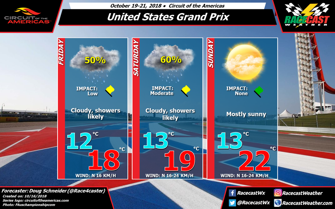
A frontal boundary is going to be stalled over eastern Texas for much of this week, bringing quite a bit of rain to the region through Saturday. The front will be positioned near the coast, while winds across the Gulf of Mexico will be blowing from east to west, up and over the front. This moist air rising over the front will keep cloudy skies over COTA along with a good chance of rain each day this week. With the persistent rains, flooding could be a concern across eastern Texas all week. Temperatures will be cool with a northerly wind and overcast clouds, and highs will only reach the mid to upper 60s Friday and Saturday. The impact on the racing action on Friday is Low, as it appears that rain on Friday will mainly be light, with amounts in the range of a tenth to a quarter inch. The rain on Saturday has the potential to be heavier, between a quarter and a half inch, so I have the impact as Moderate. This means that delays to the scheduled on-track activity are possible, and rain tires will be needed, but it should not be enough to cause cancellations.
The good news in this forecast is that another front will push from north to south across Texas on Saturday night, with a strong high pressure ridge building in behind it on Sunday. This will bring drier air to the region for Sunday, and race day should be very nice. With mostly sunny skies and a north wind at 10 to 15 mph, temperatures will reach the lower 70s during the race.


