
By Scott Martin - @RaceWx4You
At this point leading up to this upcoming weekend's Indycar Grand Prix at Indianapolis Motor Speedway, the forecast is not all that bad at all... but it is way better than last year's event if I remember correctly.
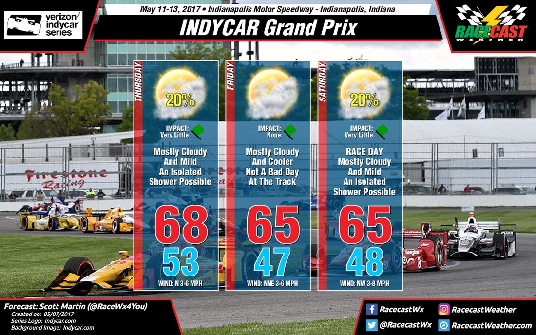
Thursday looks to be a mostly cloudy, if not a completely overcast day, at the track. The latest GFS model is painting moisture in and around the area throughout the day, but the good news is that much of the rainfall will be before the 7AM hour and after the 7PM hour. So much of the day, if not all, will be dry at the Brickyard. I'm including a very small chance of an isolated shower or two to move in or across the area, with the odds of receiving rain at 1 in 5 (20%). If any rain falls, it will not be heavy with totals of less than 1/10th of an inch likely... thunder is not expected at all. Afternoon highs will be in the upper 60s, near 68 degrees. Winds will be light out of the north at 3-6 MPH.
Friday may be the best day of the week, as dry conditions are expected as of now throughout the day. It looks to be a mostly cloudy day, but I wouldn't be surprised if the sun broke through a few times. Afternoon highs will be in the mid 60s, around 65 degrees. Winds will once again be light out of the north-northeast at 3-6 MPH. The odds for rain is not an absolute zero, but the chances are so low that they are not worth mentioning at this point.
Clouds will once again be covering the sky across the Indianapolis area for Saturday, and there is a very small risk for an isolated shower at some point during the day... most likely during the afternoon hours. Odds are better than what they were on Friday, but less than Thursday... so less than 1 in 5 (20%). Rain will be light, if any falls, and totals will be well less than 1/10th of an inch. No thunder is expected at all. Afternoon highs will once again be in the mid 60s, around 65 degrees.
I'll have a better look at the forecast tomorrow, especially with a good look at the high-resolution models when those come in. I will have radar up and running on Thursday. Check back on our social media feeds and on the site for the latest updates.


