
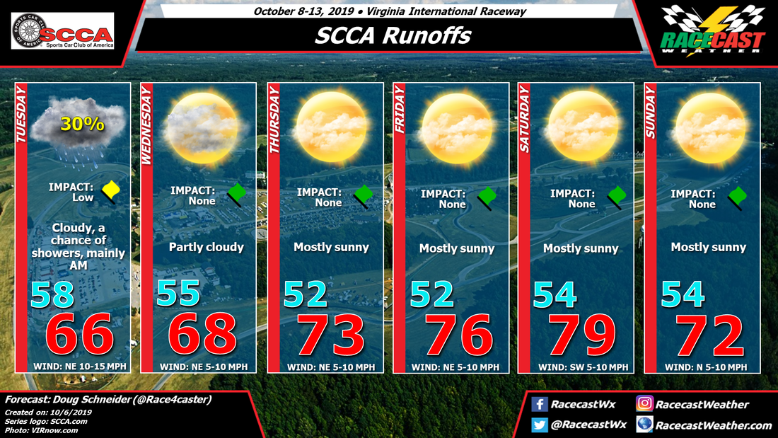
The SCCA Runoffs will be held at beautiful VIR this year, and the weather looks great for most of the event. Only Tuesday's qualifying sessions will have a threat of rain, and temperatures throughout the event will be very pleasant.
A cold front will pass through the VIR area on Monday, and surface high pressure will build in behind it. However, there will be an upper level disturbance that will follow the front on Monday night and Tuesday morning. This disturbance in the upper levels could bring a few scattered showers to the VIR area as qualifying begins on Tuesday, mainly during the morning hours. Any rain that falls will likely be light, maybe around a tenth of an inch all day.
Through the rest of the week, high pressure will be centered over New England and southeastern Canada, extending southwest along the east side of the Appalachian Mountains. This will keep a northeast wind across Virginia and North Carolina, providing comfortable temperatures and low humidity. There will be a gradual warming trend as the weekend approaches, with highs peaking in the upper 70s on Saturday as the high loses its grip and a southwest wind develops.
Another cold front is expected to cross the area on Saturday night, which will drop temperatures again for Sunday. Right now, it looks like this frontal passage will be dry, and highs on Sunday will be in the lower 70s. That is still far out in the forecast, and this front does look like it will be quite strong, so temperatures on Sunday may end up being cooler than that.
Check back through the week for updates.


