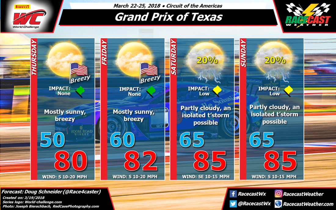
A high pressure system at the surface will be east of Texas on Thursday, producing a southerly wind between 10 and 20 mph. In the upper levels of the atmosphere, there will be a high pressure ridge that will provide stable conditions that will suppress the development of showers and storms. That pattern will continue into Friday.
On Saturday, the upper level ridge shifts to the east, and a low pressure system develops near the Rockies. A southerly wind will continue to provide warm temperatures each day, but the question is whether there will be enough lift in the atmosphere to allow storms to develop on Saturday and Sunday. With the upper level ridge moving away, and the low pressure system to the north tracking across Kansas, there is a chance of some storms to develop. If they were to occur, they would probably be in the afternoon and evening.
Forecasting how storms will develop this far out is really difficult, so I don't have a lot of confidence in what will happen, but I will mention a 20% chance of showers and thunderstorms both days because they are a possibility. Stay tuned through the week for updates.
Thanks to Joseph Bierschbach of Red Case Photography for providing the beautiful photo for our forecast graphic.


