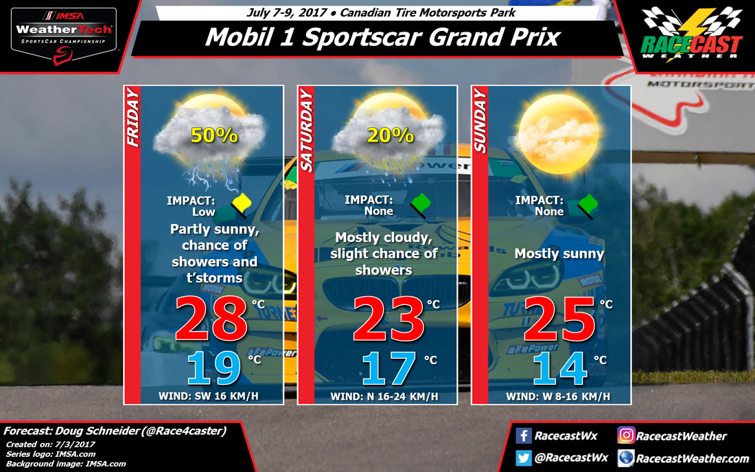
Friday's practice sessions have the best chance of seeing wet conditions. An upper level trough and a surface cold front will be approaching the area from the northwest, and with a little daytime heating, showers and thunderstorms should develop across much of Ontario during the day. The afternoon is probably going to have higher rain chances than the morning due to more instability, but timing is still too uncertain this far out to be confident about that.
The cold front is expected to move across southern Ontario on Friday night, taking the bulk of the rain with it, and the models are in pretty good agreement about that. However, they differ on how fast the upper level trough moves through, and so I don't have a lot of confidence about what will happen on Saturday. I have a slight chance of rain mentioned on Saturday to account for the possibility of the slower scenario. Even if there is rain on Saturday, it will most likely be light and have little impact on the racing. It is possible that the trough could move through faster, taking the rain away on Friday night, and Saturday could stay dry. In either case, it does look like cooler temperatures will build in behind the front for Saturday, with highs in the mid 70s (lower 20s C). It will be a little breezy too, with a north wind at 10-15 mph.
Sunday looks like a great day for racing. The models agree on high pressure building over the Great Lakes, and a dry north to northwest flow providing dry air aloft. I expect mostly sunny skies and highs in the upper 70s (mid 20s C).
Follow along on all our social media feeds on the right sidebar to keep up with changes in the forecast through the week.


