
By: Stephen McCoy
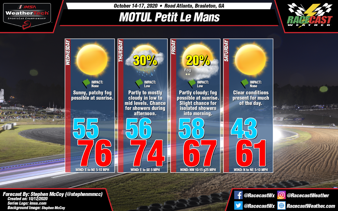
Expect a warm start to the weekend for this weekend's MOTUL Petit Le Mans before a cold front passes through the region on Friday, which will bring a chance for showers ahead of it either Thursday afternoon or overnight into Friday morning. Cooler temperatures are anticipated after the front passes, with only a high in the low 60's for race day.
High pressure will move into the region on Tuesday, remaining present until Friday when a cold front approaches from the west. As a result of the high, and drier air aloft, clear conditions will be present for the day with light winds from the east to northeast. A temperature inversion is expected over the region Wednesday morning, and if dew point temperatures are warm enough, some patchy fog may be possible. Slightly cloudier conditions are anticipated for Thursday as the cold front begins moving through the southeast. Surface winds will once again be light, though from the east to southeast, but increasing and shifting towards the southwest overnight into Friday morning. There is a chance for scattered showers ahead of the front on Thursday, with another light round of isolated showers possible on Friday morning.
The possibility of overnight rain will also bring the possibility of fog Friday morning as the southerly winds ahead of the front cause the surface to become more saturated. After the front passes through, winds will increase from the northwest, with cloud cover gradually decreasing into the afternoon and evening. The cooler air behind the front will result in low temperatures for Saturday in the low 40's and warming to a high around 60 along with clear conditions for much of the day.


