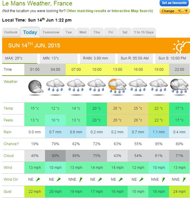
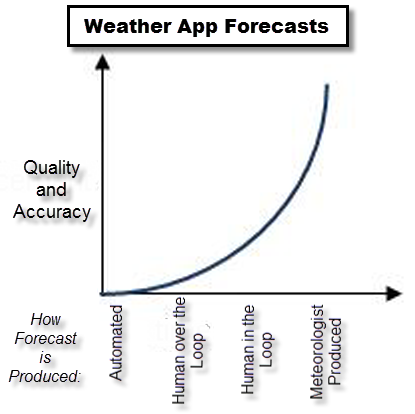
By Doug Schneider
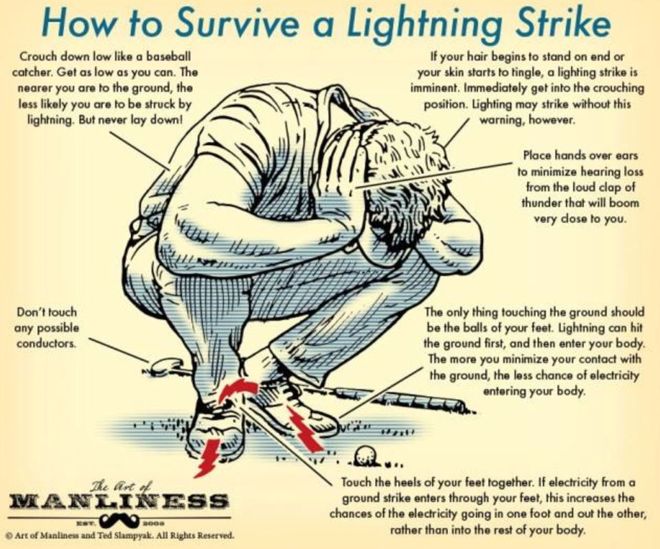
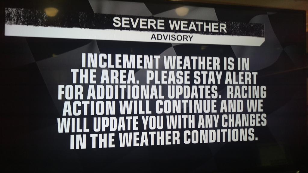
I ran across this graphic today that shows what you should do if you are caught outside when lightning is nearby. Of course, the best option is to find shelter. But at race tracks, that is often not an option for everyone. If you have no other choice, this is the position that will give you the best chances of surviving a lightning strike. (H/T - Mike Smith Enterprises Blog)
I ran across this graphic today that shows what you should do if you are caught outside when lightning is nearby. Of course, the best option is to find shelter. But at race tracks, that is often not an option for everyone. If you have no other choice, this is the position that will give you the best chances of surviving a lightning strike. (H/T - Mike Smith Enterprises Blog)