By Doug Schneider
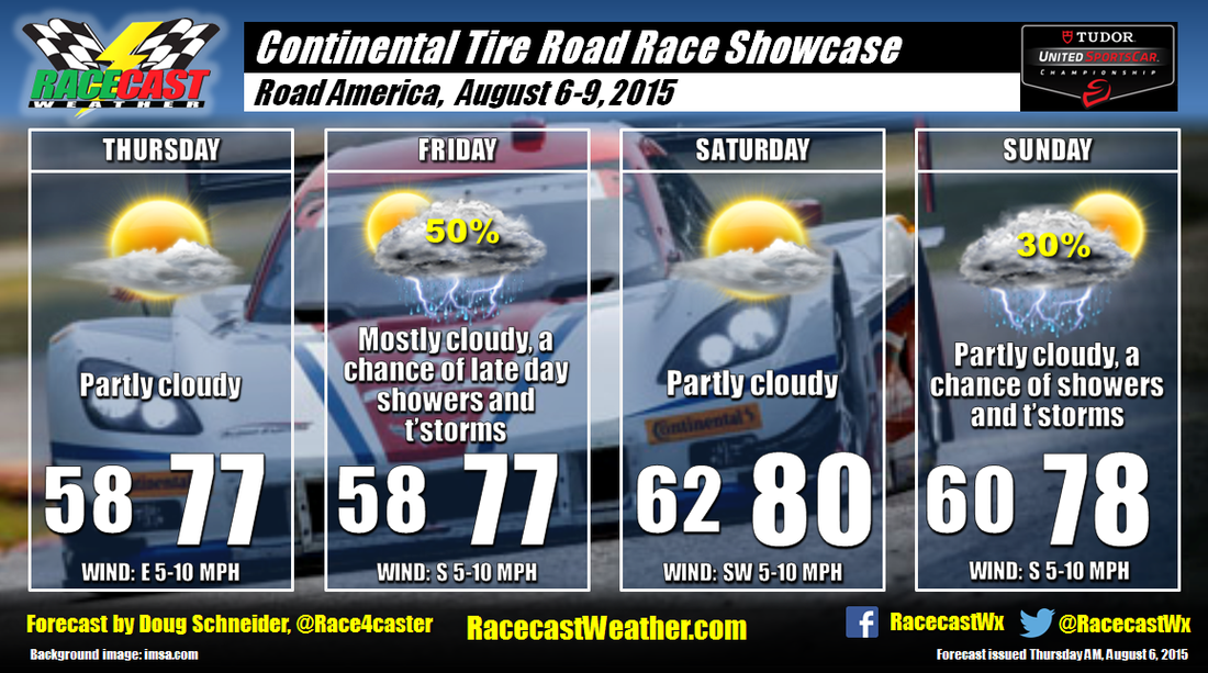
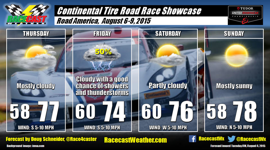
Today will be a nice day at Road America as high pressure sits over the Great Lakes. With partly cloudy skies, high temperatures will reach into the upper 70s. On Friday, the high pressure area will move east, and a low pressure system will approach from the northwest. This will bring a chance of showers and thunderstorms to the area in the afternoon and evening hours.
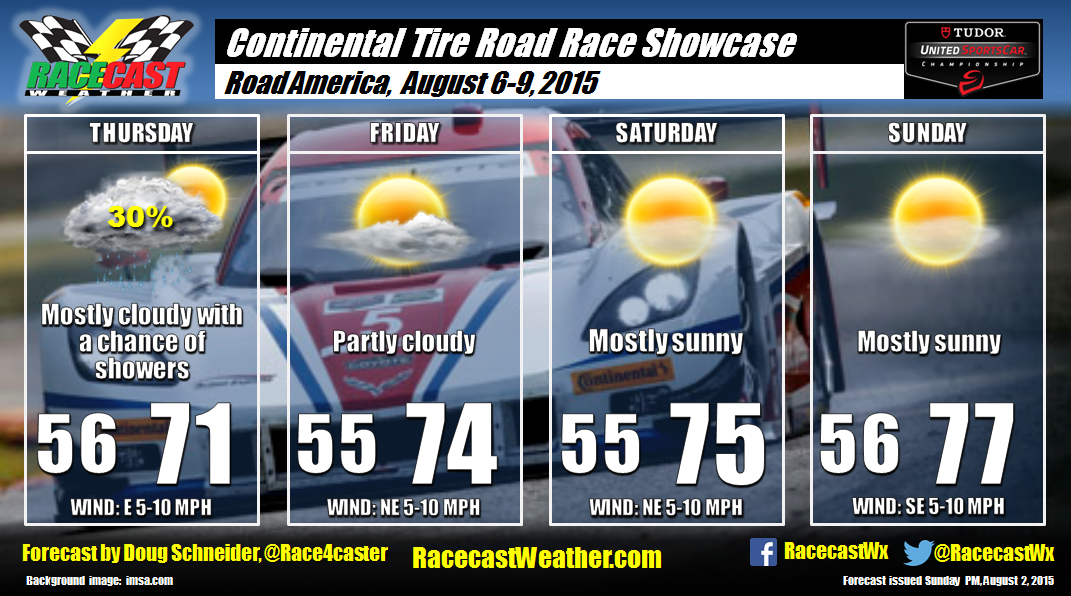
There is still quite a bit of uncertainty for Saturday and Sunday as the models are flip-flopping about the chances of rain. The problem is that the weather features that could produce some rain are subtle, and the models don't handle this type of pattern well. Some show rain on Saturday, others only have rain Sunday, and others have no rain at all. So my confidence remains low. I will stick with a dry day on Saturday with temperatures rising to near 80. It is starting to look like showers and thunderstorms are possible on Sunday as some models show an upper level disturbance approaching from the west. However, other models don't show this. With so much uncertainty, I am keeping the chance of rain low at only 30%. I need to see better model agreement before going higher. Hopefully, things will come into better focus tomorrow.
There is still quite a bit of uncertainty for Saturday and Sunday as the models are flip-flopping about the chances of rain. The problem is that the weather features that could produce some rain are subtle, and the models don't handle this type of pattern well. Some show rain on Saturday, others only have rain Sunday, and others have no rain at all. So my confidence remains low. I will stick with a dry day on Saturday with temperatures rising to near 80. It is starting to look like showers and thunderstorms are possible on Sunday as some models show an upper level disturbance approaching from the west. However, other models don't show this. With so much uncertainty, I am keeping the chance of rain low at only 30%. I need to see better model agreement before going higher. Hopefully, things will come into better focus tomorrow.