By Doug Schneider
The remnants of the tropical system formerly known as Alberto will be dumping quite a bit of rain across the Detroit area through tonight. The abundant moisture associated with it will exit on Thursday, so it won't interfere with the on-track activity, which begins on Friday.
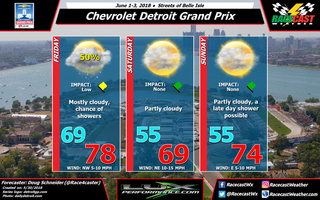
There will be a cold front passing across the area on Friday, probably around noon, followed by an upper level trough passage in the evening. With the front and upper trough in the area, the forecast continues to have a 50% chance of showers through the day, with mostly cloudy skies. I think the coverage of showers will be scattered, with a 50/50 chance of a shower hitting the track. The wind will start from the southwest in the morning, then shift to northwest once the front moves through, and increase to around 10 mph.
Behind the front, high pressure will build in from the north, and provide cooler and drier air for Saturday. It looks like it will be a great day to be at the track and enjoy some racing action, with partly cloudy skies and a high temperature around 70. There will be a northeasterly breeze at 10 to 15 mph.
As I mentioned in my last post, Sunday is a little more uncertain. The models are showing the high pressure system exiting and another upper level trough approaching the area, which brings some rain late in the day. At this time I think it will hold off until the evening or overnight hours, and not have an impact on the race. This may change with my next forecast update, so stay tuned.