By Scott Martin
So sorry for the forecast coming out so late this week. I have been preparing for the annual NWA meeting in Norfolk, Virginia, along with helping out with coordinating the WeatherReady Fest that will be taking place on Saturday at the Nauticus Science Center on the waterfront.
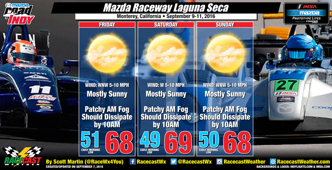
As far as the forecast, things could be better for racing at Mazda Raceway Laguna Seca. Nice and cool temperatures are expected throughout the mostly sunny weekend. No rain is expected, and the only issue will be patchy morning fog each day, which should dissipate by 10AM. Highs will be in the upper 60s to 70 degrees, with early morning lows near 50 degrees.
As far as the forecast, things could be better for racing at Mazda Raceway Laguna Seca. Nice and cool temperatures are expected throughout the mostly sunny weekend. No rain is expected, and the only issue will be patchy morning fog each day, which should dissipate by 10AM. Highs will be in the upper 60s to 70 degrees, with early morning lows near 50 degrees.