By Doug Schneider
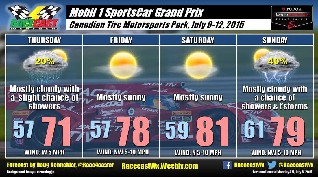
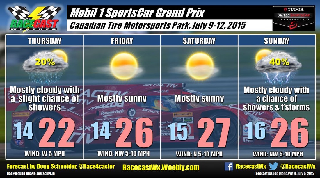
No significant changes to the forecast today, as the weather continues to look great for racing at Mosport this weekend. Saturday will feature plenty of sunshine and highs in the lower 80s (upper 20s C). Sunday will start off mostly sunny, but clouds will be increasing through the day. However, rain is expected to hold off until after sunset, so all the racing activity will stay dry.
No significant changes to the forecast today, as the weather continues to look great for racing at Mosport this weekend. Saturday will feature plenty of sunshine and highs in the lower 80s (upper 20s C). Sunday will start off mostly sunny, but clouds will be increasing through the day. However, rain is expected to hold off until after sunset, so all the racing activity will stay dry.