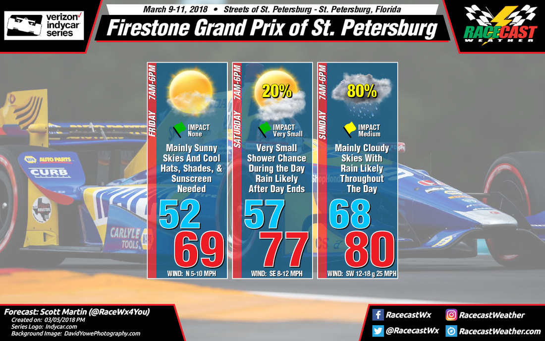
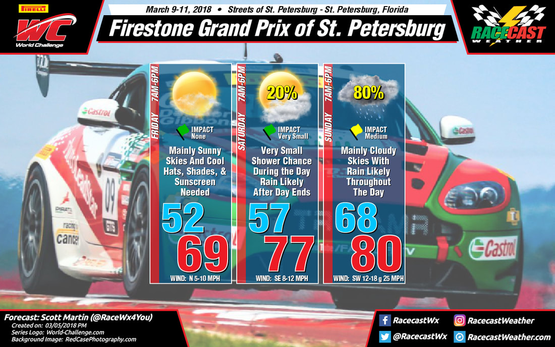
By Doug Schneider
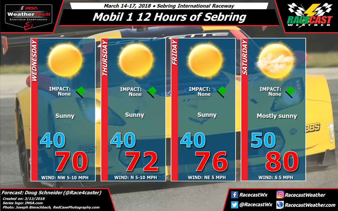
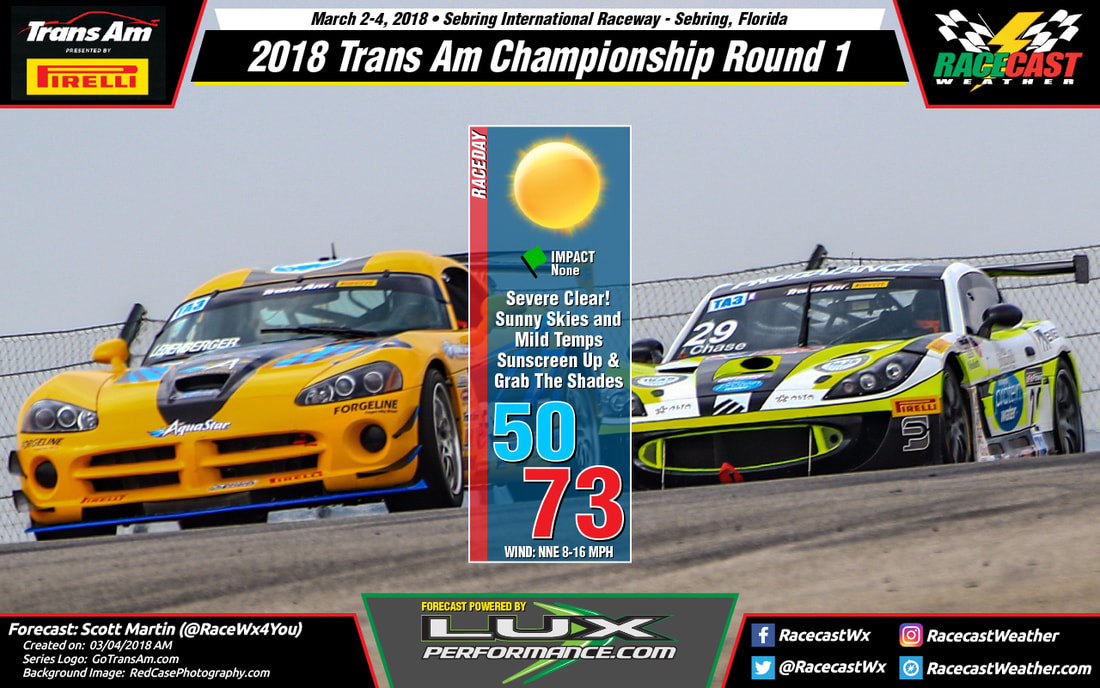
There hasn't been much change to the expected weather pattern later this week at Sebring. I only made some changes to the morning low temperatures, which are looking colder than before. It will be unusually cold for Sebring each morning, as the normal low temperature this time of year is around 55 degrees. With a dry air mass and low relative humidity, temperatures will warm quickly through the day, and the high on race day will be around 80. By the end of the race, the temperature will be in the upper 60s.
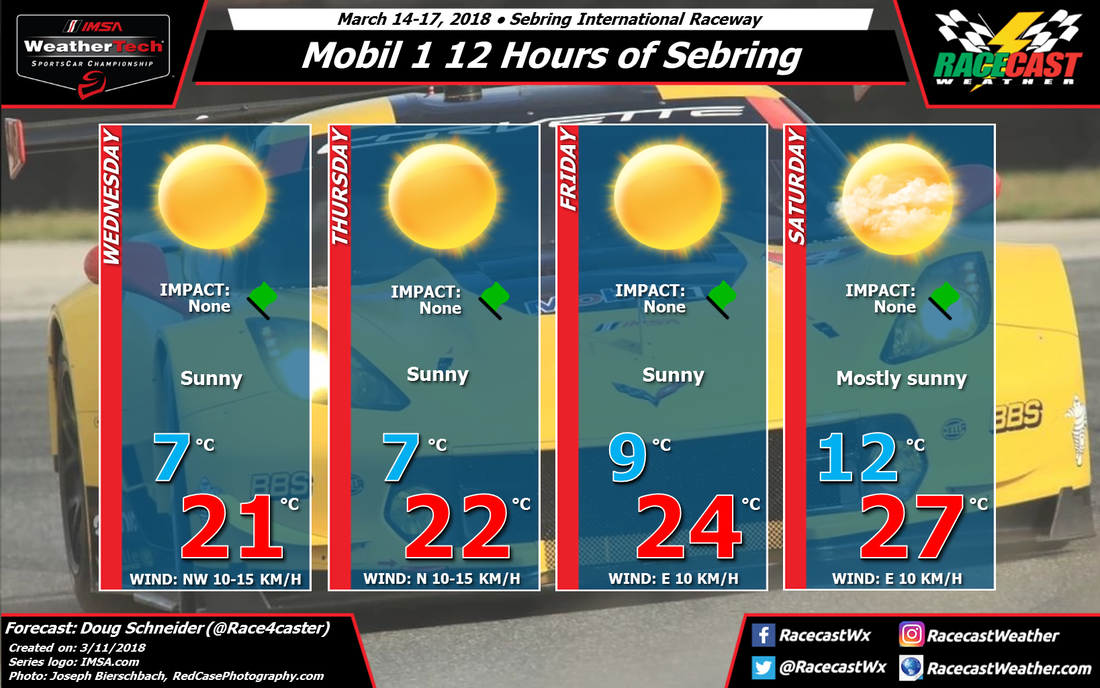
There hasn't been much change to the expected weather pattern later this week at Sebring. I only made some changes to the morning low temperatures, which are looking colder than before. It will be unusually cold for Sebring each morning, as the normal low temperature this time of year is around 55 degrees. With a dry air mass and low relative humidity, temperatures will warm quickly through the day, and the high on race day will be around 80. By the end of the race, the temperature will be in the upper 60s.