
By Doug Schneider
I'm happy to report that (so far!) the weather looks great for Petit Le Mans next weekend at Road Atlanta.
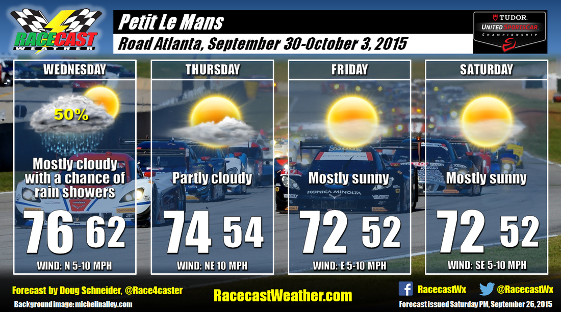
A cold front and upper level trough of low pressure will be crossing the southeast on Wednesday. The bulk of the rain associated with this system will likely come on Tuesday and Tuesday night, but there is a chance of some showers lingering into Wednesday. The system will exit Wednesday night, and as high pressure builds in, cooler and drier air will be sliding into northeast Georgia from the northeast. This should make for comfortable daytime temperatures and low humidity Thursday through Saturday. Highs will be in the lower to 70s, and morning lows may be a little on the cool side, dropping into the lower to mid 50s each morning.
The latest run of the GFS model develops a low pressure system over the Plains and moves it into Tennessee by Sunday morning. If this occurs, there could be some rain on Sunday as teams and campers leave the track. But it does not appear likely to have an impact on the racing, unless later model runs show it moving faster.
Stay tuned for updates through the week by following our Twitter feeds and Facebook page.


